Day 7 – There’s a reason Ireland is so green

A very fine morning enjoying the comfort of the Glenmalure Hostel gardens
As we sat sipping coffee in the warm sunlit garden of Glenmalure Hostel it was easy to imagine a glorious day of weather ahead, but by now I knew better. The sun may be shining in the valley in the early hours but I knew things could be quite different on the ridge and sure enough after bidding farewell to my new found friends following a fabulous breakfast of fresh pancakes I began the climb back up the trail to Black Banks Pass and could already see dark clouds closing in.
I hoped to reach four mountains today strung out over more than 20miles of rough terrain including a long ‘out and back’ to Lobawn. I had considered cutting this from the route in order to make it back to Dublin on time but after a good night’s rest I was feeling confident that I could make the distance today. In fact things went pretty well out to that summit, it was not yet raining and after some peat hag obstacle negotiation there was something of a faint path to follow and I made some good early mileage. I could clearly see a wide band of heavy rain heading my way and on the way back down reluctantly pulled out my rain gear again before it hit.
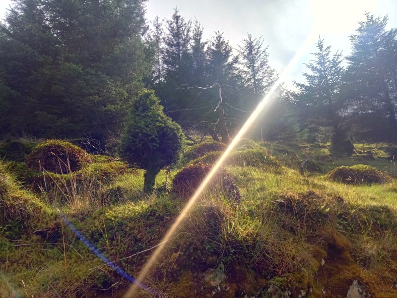
Possibly the wettest week of my outdoor life!
It continued like this for a while – heavy downpour followed by short, windy dry spell until the cloud dropped once again, visibility faded and the wind and rain became more persistent. I’ve long since learned that short cuts are rarely quicker or easier but decided to drop down into the valley to avoid a long route around the ridge and steep descent. It was slow going and very wet but I was rewarded with stumbling into the largest group of deer I had yet seen in these mountains. Sika deer were introduced to the Powerscourt Estate in Co. Wicklow in 1859 and they soon escaped and started to breed with the closely related native Red deer. Most of the deer are now likely hybrid as there are very few Red Deer remaining. I marvelled at their grace and easy agility as their barks and whistles alerted the herd to take flight up the gully onto the ridge. I could only wish I was able to move with such flow through these hills. How impossibly heavy and cumbersome I felt in comparison. I watched as they kept pausing to look back at me but ultimately decided to create a good distance between us.
 This short cut left me the wrong side of a ‘stream’ and I had a worrying sense of deja-vu when the cloud cleared enough to catch a glimpse of waterfalls coming off the hills and the loud roar of fast moving water. It was certainly bigger and trickier than I expected but after about ten minutes of scouting about for a good place to cross I picked a safe way over around the rocks, no more than knee deep and was back on a path!
On the other side of the valley my route up the next mountain was a bit, shall we say, ‘unconfirmed’, on the map. Leaving a road I entered a forestry track where I got the feeling hill goers weren’t really welcome. My onward path turned quickly off the track and continued promisingly upward in a negotiable line between the trees where others had clearly passed, albeit not often. Crossing the track again much higher up my path continued for a short way then fizzled out to nothing but a tight clump of trees. Pushing through to see if there was any onward route it was clear I had reached the end of the line. I returned to the track and reluctant to retrace all my uphill efforts right back down again followed the forestry track up in the vain hope it might pop out onto the open hillside. I wasn’t too confident as the map showed it just coming to an abrupt end in the forest and shortly that’s exactly what it did.
At that moment I spotted another deer just ahead of me and was impressed that for the first time the deer had not seen me first. That was until three others leapt from the trees, covered the track in one bound and leapt effortlessly up a three metre high cutting and back into the dense tangle of trees. For sure, they had seen me coming! I couldn’t fathom how they so easily melted into the trees, the branches and undergrowth were so thick and tightly packed it barely seemed possible for anything to squeeze through let alone such a large animal. The open hillside was less than 100 metres through those trees but there was no way I could even wriggle through on my elbows so I started back down eagerly searching for some space through the dense forest. Eventually I came to a small area that had been recently felled and a churned up machinery track wove up it to reach open land and the National Park boundary. Again I was aware I shouldn’t really be on this spot and eager to get back on National Park land I slipped and slid up the muddy channel as quickly as I could to tumble over a low battered fence onto the moor for once feeling extremely grateful to be back on that boggy rough heathery and pathless terrain which was far more accommodating by comparison.
Wet feet guaranteed!
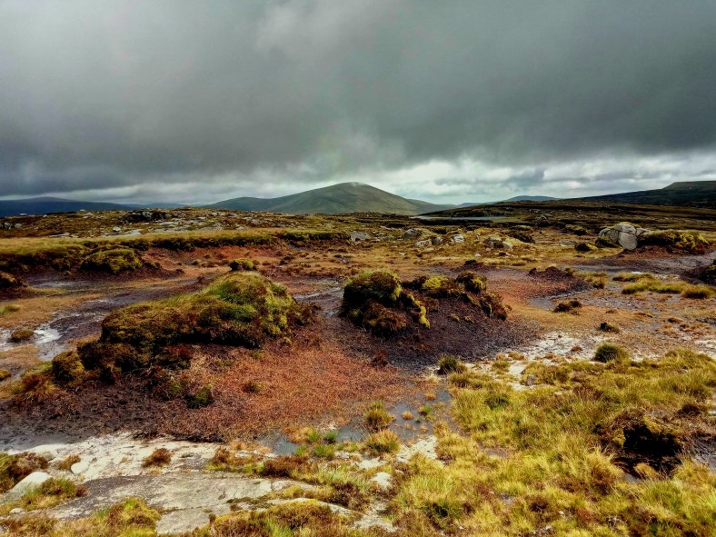
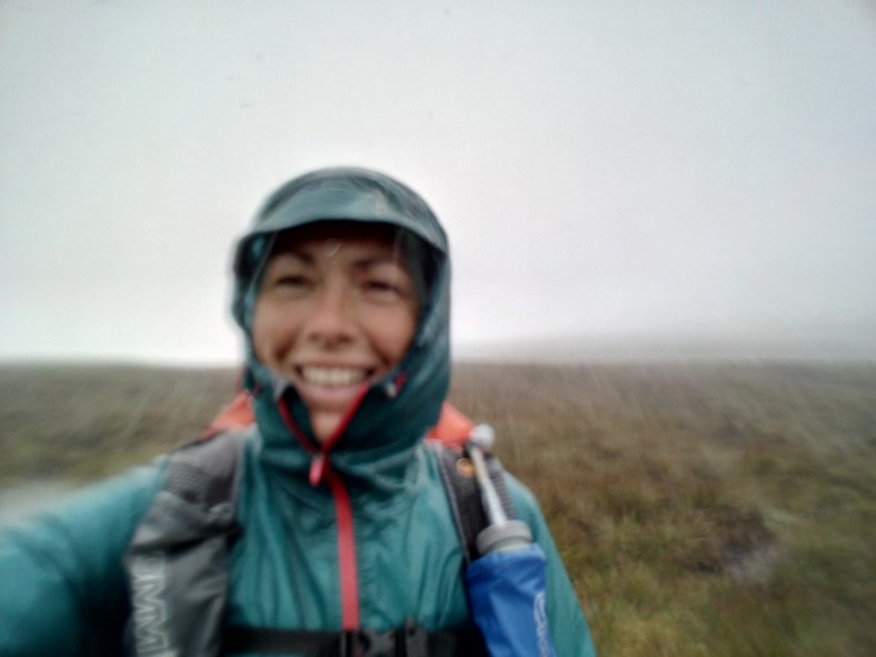
Gaining height the weather deteriorated badly and I was soon being blasted by strong side winds and sheets of very heavy rain all the way to the summit which then required a bit of bold negotiation in thick clag over a featureless and peat bog plateau. This would be the shape of things for the next few hours as I had to hold my nerve to navigate in some of the worst visibility so far over 5 miles of featureless moorland. Keeping the wind at my back I followed a bearing through the murk hoping not to come across too many peat hag bogs that would try to throw me off course in this eerily gloomy landscape.

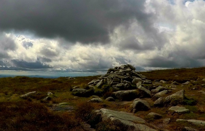
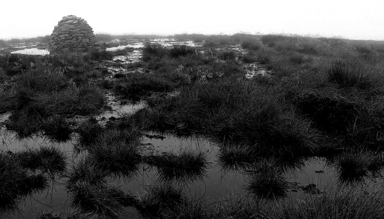
The small direction post was the only feature to navigate to on a misty Moanbane summit
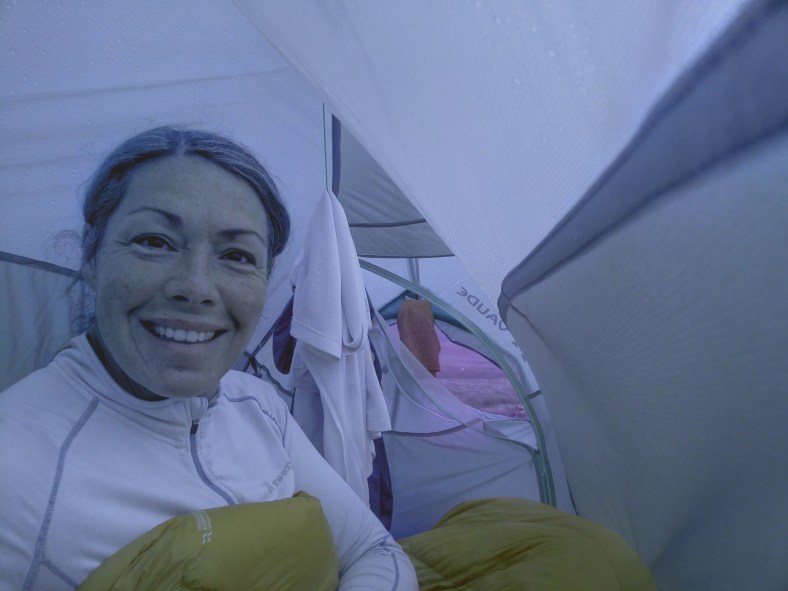
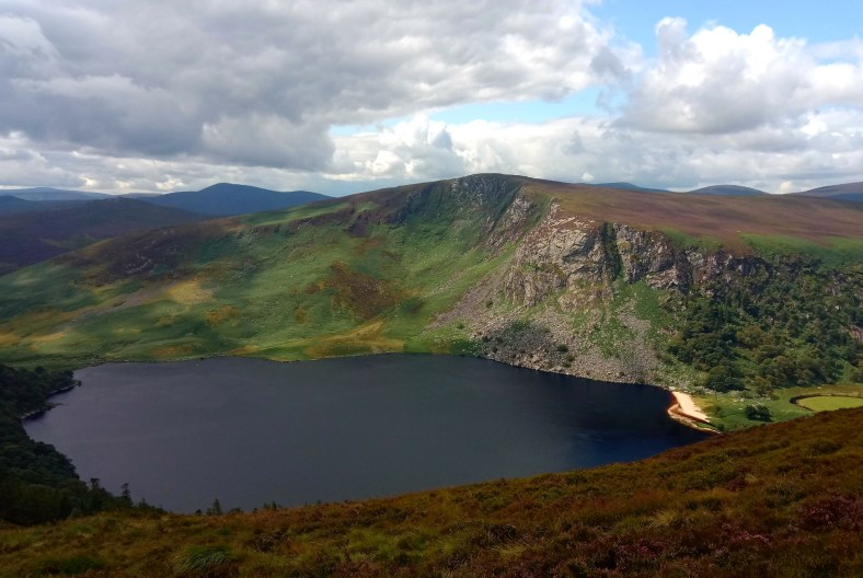
I was concentrating so hard I barely noticed the heavy sheets of whipping rain that intermittently caught up and overtook me. Finally over the wide expanse of Billy Byrnes’ Pass I dropped to lower ground and as evening crept up gaps broke in the cloud to allow a glimpse of a vast shimmering sheet of grey-silver far below – Poulaphouca Reservoir, known locally at Blessington Lake. I scoped out some wet ground that was slightly less wet than all the other wet ground and the weather was kind enough to stop raining for just enough time to get my tent up, shake off my layers and crawl inside.

I even had enough time to get the stove going to fill a flask with hot tea and cook my three minute moroccan cous cous meal. A brief but beautiful cloudy view of tomorrow mornings’ and the final mountains of my journey faced me across the valley before the cloud gently closed in again and I closed up the tent zips as the first drops of rain began to fall.
Day 8 – Dublin bound for a drop of the black stuff!

Final Day in the Wicklow Mountains
It was 46 kilometres and four final mountains to the end of my plotted trail back to Dublin which I had to reach today as it was time to return to work. I suspected the terrain over these final hills would be a little easier going than that in the heart of the National Park and now I had eaten most of the food in my pack it was weighing in a few kilos lighter. It was still an ambitious distance and I was pretty tired from the tough week but I was lucky to meet Avril, a very kind lady from Larack, herself a keen hill-goer who insisted on giving me a lift along the long road section of my route to the foot of Seefin, a popular summit with an ancient Passage Tomb burial chamber situated at the top.
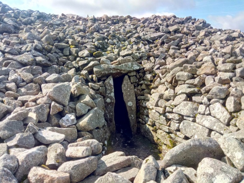
The Passage Tomb on Seefin
Though I did originally want to complete the entire circuit on foot I had already had to make a few adjustments due to delays and so wasn’t feeling so purist about these road miles. I was there, after all, to summit the mountains so I happily accepted her offer and we zipped along the rural back lanes exchanging outdoor adventure stories and her tales of Wicklow life while I tried to apologise for the seriously rank smell that was by now a constant emanation from my wet feet. Before long we were wishing each other farewell and I stood at the bottom of a climb to Seefin summit now with a much more manageable 34 kilometres ahead, just over 21 old-school miles!

A fantastic spot by the river for an early lunch cook-up.
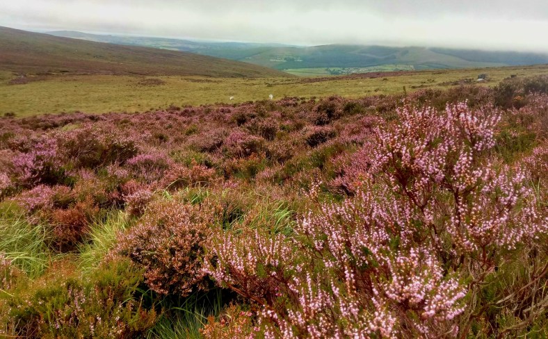
Today turned out to be the best weather day of the entire adventure. Sunny spells and not a single shower hit me – it felt as though the mountains were finally rewarding me with a show of glorious beauty for all my tenacity battling through everything they had thrown at me over the week. It was certainly a perfect way to finish the journey with long views back over the wild mountains I had traversed. I tip-toed over a couple of easy stream crossings, enjoyed the riotous colour of swathes of hillside heather and followed well used trails over these final mountains – I even saw five other people out in the hills today, a veritable crowd by previous standards!
 Reaching Corrig Mountain and Seahan the entire city of Dublin was laid out below and it was quite a contrast to look north over the vast developments of the city and its surrounds and then glance back over my shoulder to the miles and miles of wild, deserted moorlands through which I had passed.
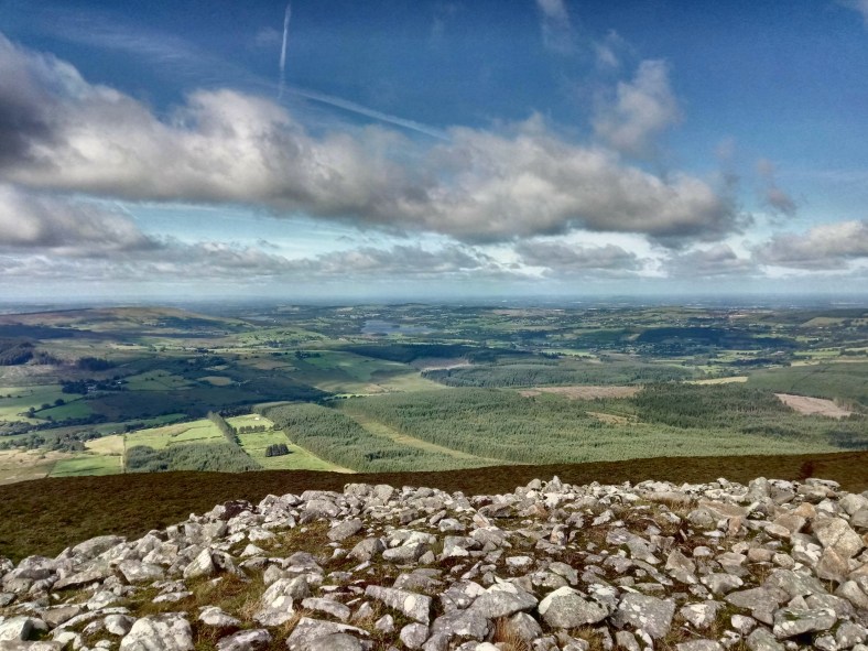
A long view toward Dublin Bay
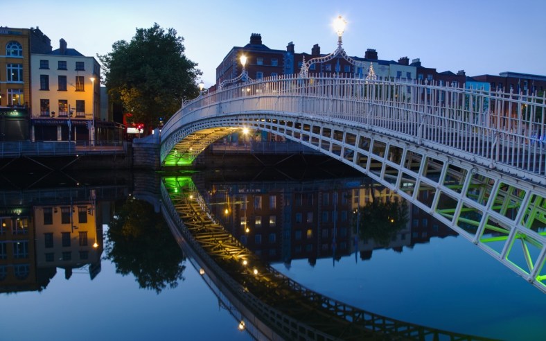
It would be odd to return to the frenetic pace and noise of the city and I really wished I had more time to pitch up my tent and watch the bay from afar, especially as it was now, suddenly, brilliant wild camping weather! But all that was left was the long downhill to the outskirts, suburbs and increasingly urban landscape below and a couple of hours later I was sat in a pub celebrating my ‘Wicklow Round’ with the obligatory glass of Guinness.

A VERY welcome celebratory Guiness!
I had covered 208km (130miles) on foot with 7600m of elevation gain and loss and managed to ‘bag’ 35 of the 39 mountains. Considering how testing the week had been I was pretty happy with the result and the four elusive mountains that remained meant that I would soon return to this beautiful region, after all, surely the weather couldn’t ever be any worse!?

Leaving the wonderful, wild, Wicklows for now…..but I’ll definitely be back!
During my #RunningtheSummits challenge I hope to summit 1000 Mountains of the UK and Ireland – you can vicariously join the adventure at Running the Summits on Facebook with regular posts about fantastic routes (and #type2fun days😉) in our fabulous hills.
Happy trails😁👣


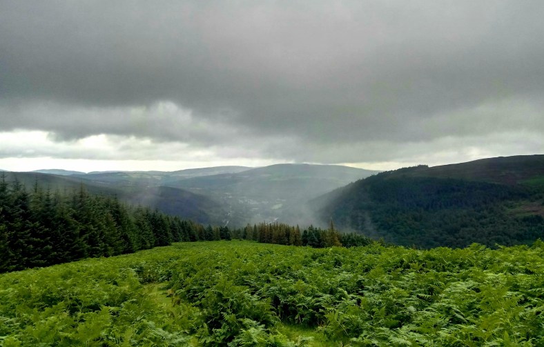 Incoming shower…
 Lugnaquilla provided an easy and gentle summit despite looking uninviting from below!
 The welcoming cosy hearth of the Glenmalure Hostel…..and no sign of ‘Scary Mary’
 Down into the peaceful Glenmalure valley