Appreciating the luxury of travel and adventure – living a simple life on an African research station.

Today I was reminded of another very different time in a very different place, but where day to day life had a few similarities to my current life at tinyvan basecamp . How it all came about is a bit of a long story but to keep it brief, some years ago I was extremely fortunate to be in one of those ‘right place at the right time’ moments and got the opportunity to work as a research assistant volunteer in East Africa…..I know….as you do, right!

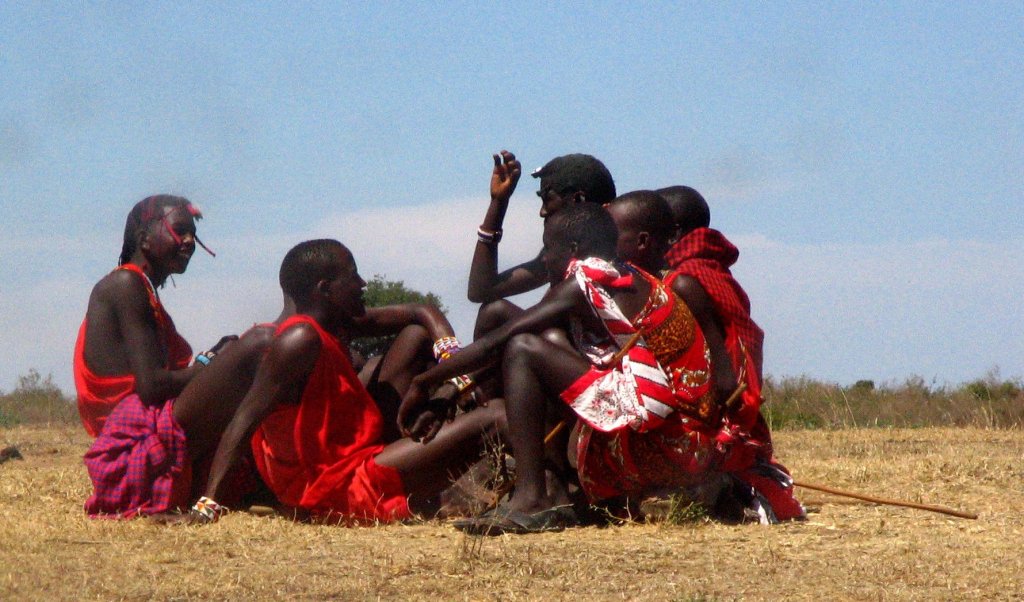
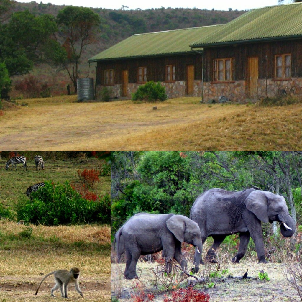
Our off-grid ‘Basecamp’ in the Maasai Mara along with regular visitors to the garden!

My basic and very limited OU online study of Mammal Biology and Marine Biology ( which bagged me a different adventure, but that’s for another time!) had paid off and bluffed up enough to get me in that ‘right place’ and, along with my eager willingness to do any unpaid mundane or repetitive chore, was enough to secure a place with a couple of other similarly poorly qualified wildlife enthusiasts at the ‘right time’ to assist a Danish scientist with the observation phase of his human- wildlife conflict study in the TransMara region on both sides of the Maasai Mara game reserve boundary in Kenya, East Africa. There’s an awful lot to the study but that’s not what this blog post is about so it’s suffice to say our main task at that point was finding and following particular lion prides and monitoring their behaviour over two separate, four hour periods per day. As the lions sometimes took a bit of finding, plus a fair distance might be travelled over rough terrain from our base and there were also other activities involved our days were generally split into four periods with at least half the time tracking and monitoring the lions and half the time at base usually sleeping for two four-hour periods as we would be out during the night too.

Discovering the secret life of lions….mostly it involves sleeping!

Already I am digressing and you might be thinking this doesn’t sound anything remotely like how my current day to day living could possibly be but let me explain why this experience came to mind today.

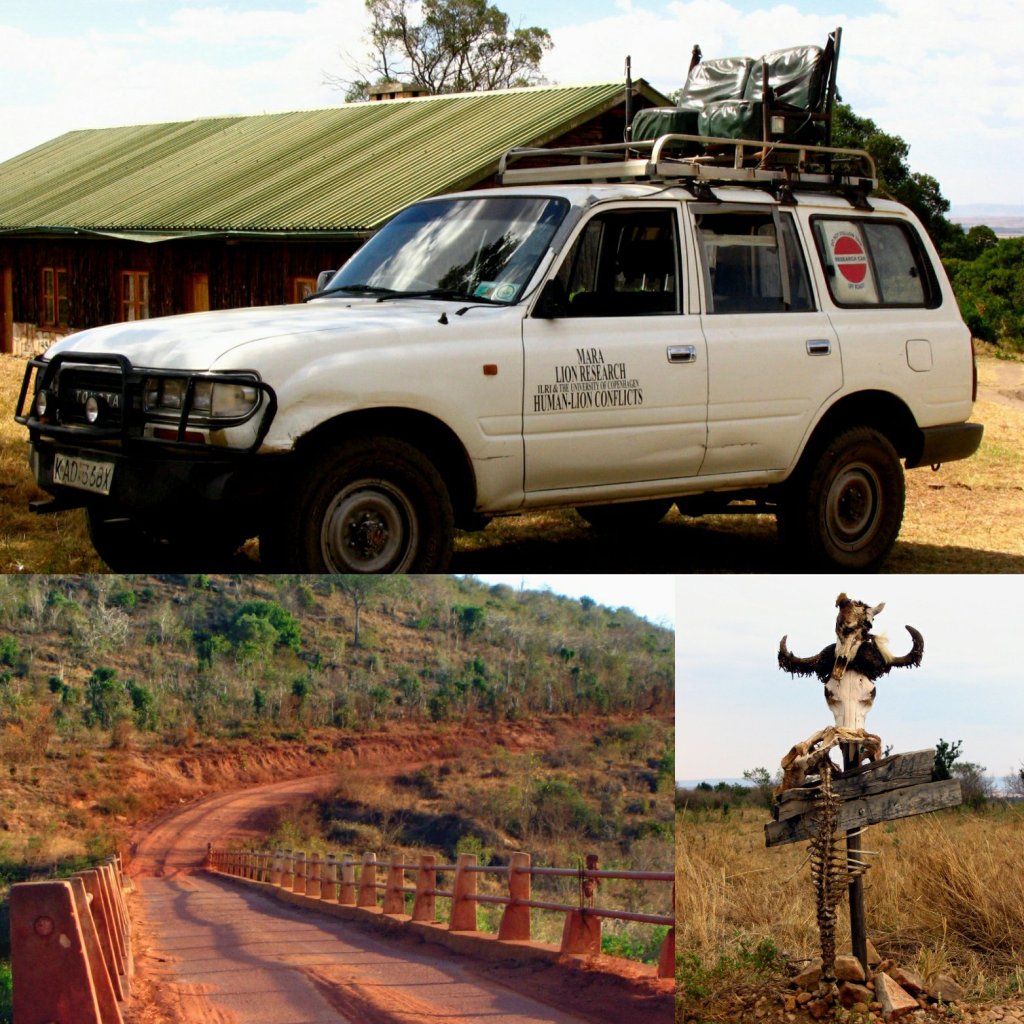
Transport was often in chairs on the vehicle roof occasionally along rough roads but mostly completely off-road and the road signage wasn’t always clear!

Our base was remote and very basic. A few simple buildings comprised a couple of offices and equipment stores and accommodation in simple rooms with concrete floors and wobbly wooden window frames. There was a nearby water tank from which a gravity fed pipe ran a fairly reliable trickle of water to the ‘kitchen’ for washing, cold showers and cooking. We had to bring in the drinking water for the western stomachs in our small group so the stash of 20 litre, refillable bottles stacked against the wall were a prized possession and not a drop was wasted. A trip to the supermarket for a ‘big shop’ in Nairobi, a 10 hour hot and dusty round trip, was a mission in itself and was made only once a month so a certain amount of stockpiling was necessary, planning ahead a month of meals became a ritual and in the beginning I was very guilty of my own bit of chocolate biscuit panic buying! There was the occasional opportunity to visit a small settlement at the Sekenani gate just a few miles away from the research station which, at that time, had a rickety wooden shack serving the local community with luxuries such as batteries, toilet rolls and Cadburys Fudge Bars! Planning meals, rationing supplies and making the ‘big shop’ all became a much bigger part of life than it ever was in my comfortable flat in north west England where a supermarket and two local stores provided almost round the clock access to food and provisions within 500m of my home, not to mention a local high street crammed with shops that could supply me on a daily basis with an easy and endless stream of stuff I didn’t really need. Right now, at lockdown Basecamp, I am rediscovering the simple enjoyment of not having access to everything I might think I need, savouring and appreciating the things I do have, getting creative with meal plans and planning a restocking run to a supermarket every 10 days or so like a military style operation! However, I am suffering from a near future shortage of toilet roll, and I haven’t had a Cadburys’ Fudge since 2006!

A typical teenage get together

Another fact of life on the research base was a lack of freedom of movement and exercise. Despite having the whole Maasai Mara as my back garden, it would be reckless and irresponsible to wander off into it on foot. The water tank was situated a few hundred metres away and if we needed to check on it it was standard procedure to go with another person, during main daylight hours, with no lingering on route and always keeping a sharp 360° lookout for dangers. Lions, leopards, buffalo, stroppy young male elephants, a feisty bunch of hyena, snakes and baboons and a whole array of small stuff were among some of the potentially awkward encounters. Social distancing from other animals was absolutely imperative and if that wasn’t a lot lot further than two metres then you were likely to pick up something pretty nasty indeed! On more than one occasion some of the group were caught out when the vehicle we were normally confined to on any trip out of camp broke down, as it had an equally annoying and alarming tendency to do, and stumbled on some buffalo while trying to sneak back to camp after dark, this usually resulted in a couple of hours sitting in a tree out of reach until the buffalo forgot about them and moved on. Going out on foot was not something you just did lightly! Even the ever present little vervet monkeys shielded indoors with us when a troop of baboons passed by just metres from the front door (or at least they would have given half the chance, as they were incredibly ingenious at finding ways of breaking in and trying to steal our rations – if they made it to the veg basket a vervet monkey could devour an onion as if it were an apple in seconds.)

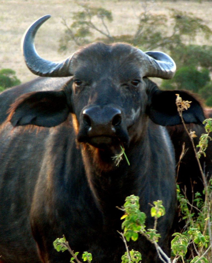
Buffalo : Very best to be avoided if on foot….can be seriously cranky!
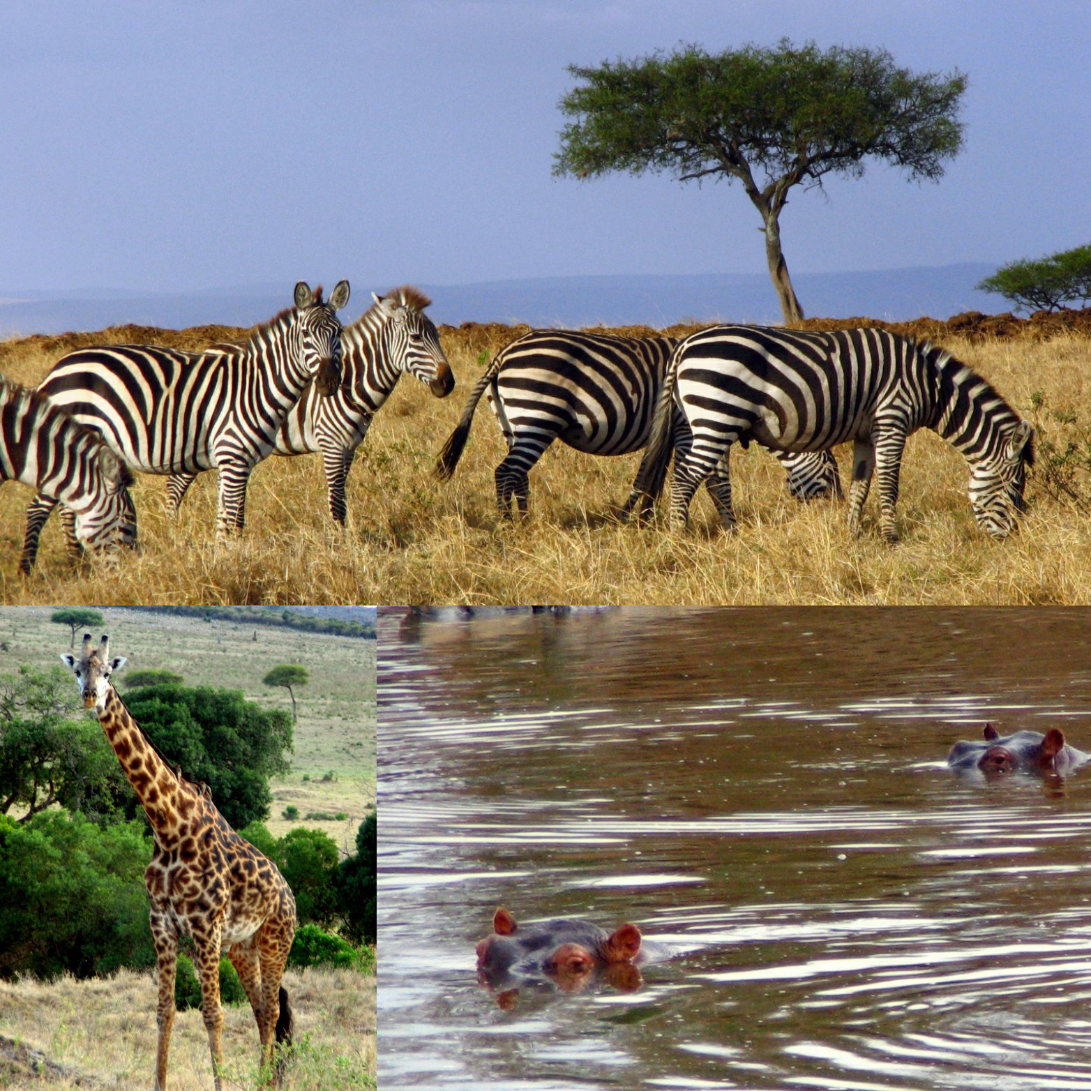
A wild land of incredible wildlife

We were also surrounded by ever present health concerns other than the obvious damage that could be caused by a disgruntled buffalo. Amongst other viruses, the population lived with the constant risk of contracting malaria and in a similar reaction to the way in which people in a  supermarket aisle might dramatically scatter if you started coughing today, every time I sneezed it was a crowd stopper and a helpful person would advise me to seek a doctor as I might have malaria, though most likely it was just a bit of hayfever! These were usually jovial exchanges but it showed the constant threat of disease that people lived with on a day to day basis.

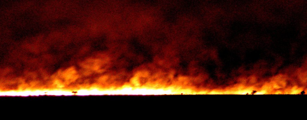
Unexpected danger when a huge wildfire swept through area

Despite busy periods there was also a lot of downtime when the lead scientist had to go away or the rangers had time off to visit their families and nothing was happening. Isolated on the station and without the usual distractions – no internet, TV or BBC iPlayer – time was spent quietly enjoying many hours gazing over the scenery, watching wildlife pass by or witnessing the occasional confrontation play out close to camp. There was time to enjoy grand African sunsets and sunrises, learn to get creative cooking with basic facilities, work on a bit of simple building maintenance, do laundry in a bucket, write a journal, read, and even sew clothing by hand, which I might add is an incredibly slow endeavour. My days are spent in a similar way now, as life settles into a calm routine, I spend time that I never could find before to read, write, draw and get in touch with friends. I have a new ritual each evening preparing a hot chocolate with just a smidgen of rum to enjoy while watching the sun set on another day in our new reality. My wildlife encounters here at tinyvan basecamp are limited mostly to the ‘big game’ entertainment from the Shetland ponies in my charge and the occasional glimpse of the tail end of the resident mole who, if his building work is anything to go by, has quite the sizeable estate constructed beneath camp. On the research station at dusk, you could almost set your watch by the bats that would pour out of the cavity in the walls of the buildings to take flight every evening and now I find myself watching the similarly ‘like clockwork’ busy evening commute of birds back to somewhere southwest of me that I can only assume is a local reservoir watering hole.

Learning how to make THE best chapatis from Mama Sheila
There were many projects to get involved with – this was for a visitor centre on the Kenyan coast.

Another aspect of the self sufficiency of research station life was a lack of electricity. I know most of us in these lockdown times have mains resources but here at my tinyvan basecamp I am without any utilities and my usual back up procedure of plugging in a power pack over a couple of cappuccinos at Costa coffee is no longer available. As, like my time on the station, I am once again reliant on limited resources, only gaining power when the sun is shining, and therefore exercising consideration to my use of devices and such. With no possibility of Netflix marathons unless we have a heatwave I reduce my use of devices relative to available resources. Again, I do enjoy this sense of rationing and appreciate ‘movie night’ all the more for it, particularly if I can manage to pop some corn on my rocket stove! At the research station we had a generator which was rationed to two hours per evening mostly for the scientists equipment to be recharged. For reasons I never figured out the generator was in a small outbuilding situated some distance from camp and at the end of the evening one of the armed KWS Rangers would have the short straw of making the short trips in the dark to turn it off. As we retired to our beds we always knew he had made it there as the lights gently dimmed and faded out but we never knew for sure if he had made it back until we were relieved to see him again at breakfast. There was always at least one ranger onsite and it was strictly their job only to fulfil this task and they would not allow anyone else to go on their behalf. Because of this we quite often decided to go without the electricity unless it was necessary for the equipment. On those evenings I’m sure I heard a sigh of relief from the designated ranger as we all sat around a blazing campfire closeby, enjoying a prized beer from the dwindling supplies until running the gauntlet of the next ‘big shop’.

The unmissable daily show…


Wet Windy Winters….Pack Fast and Light but Take Everything!

You can never be prepared enough for winter in the mountains and certainly during this winter of unprecedented wet and wind! Yesterday, all three pairs of my gloves were wringing soaked and by pair number two I had made a decision to cut my route shorter than planned as I knew there was no way I would be able to keep sufficiently warm for the time it would take to get round all my planned summits. The terrain was slow going with copious slush and bog and the rain and hail was persistent if not torrential coupled with a strong chilling wind which bit to the core. I was warm enough and had spare gear including emergency kit when I made the decision to change plans but I could foresee where things were heading and the wet was already through two layers of dry bags. If my hands went numb while still up high things would start to go downhill from there, if you pardon the pun! Running or hiking in the winter mountains takes a bit of extra preparation and forethought. As well as being prepared, staying flexible and having secondary or “thirdly” (I know, it’s “tertiary”😉)route plans is essential to avoid your adventure turning into a pile of misery or worse.

A Wet and Windy Calf Crag

Still smiling even though the rain has made it through to my pants at this point!

And things might not always appear obviously weather challenged. On a different, particularly picture postcard morning the sun, in a deep blue sky, illuminated a vibrant autumnal colour scheme as its beams slanted low across the fells, and a powder sugary white dusted the higher ground, sparkling and wondrous as wispy, white clouds scooted across the sky, punctuated by only the highest peaks. A day where I would be grabbing my pack and falling over myself to head out quickly, revelling in the lack of rain and claggy gloom. But another aspect of the weather demanded consideration. Perhaps invisible from indoors except by the tell tale signs of bending trees and the speed with which those clouds were zipping by I was well aware of it as the #tinyvan was shaken and buffeted as it roared around me. The wind! Keen as I was to get up high and soak up the glorious scenery the wind speed would only increase the higher I went and a narrow ridge with a side on wind gusting to 70mph was not a smart place to be. Not to mention the windchill would be below -10°C. The forecast predicted the winds were to die away quickly around lunchtime so common sense dictated it would do no harm to wait a couple of hours before setting out. This gave me time to consider the contents of my winter running backpack.

At a glance perfect conditions but extra precautions needed for that gale force wind!

Now I may well over-pack as a hill runner, experienced fell runners, after all, seem to fair perfectly well in just a vest and shorts. However, some back up kit is recommendable and it’s your own choice as to just how prepared you want to be. Personally I like to cover a fair few contingencies particularly as I am usually alone, and have the basic kit to spend a safe, if uncomfortable, night out on the hill should that situation arise. I always, for example, carry a head torch. Even if I am only heading out for a few miles at 8am because you just never know how the day will pan out. I have broken my own rule here on more than one occasion and learnt the hard way when I did leave something behind in the interests of being fast and light and not seeing a need for particular said item until later when I discovered…..well,…a real need for particular said item!

Pack for a 500 mile Bivvy Run Adventure!

With winter comes the additional weight of a few extra contingency items and my pack currently looks like this :-

  • Map in waterproof cover

  • Compass

  • Food (relative to planned time out though again, a bit extra as it’s cold and takes a lot of energy to keep warm plus it’s a lovely comfort to have a bite to eat in a sheltered spot on a rough day. Take your choice – snack bars, hot meal in flask, flapjack, chocolate, banana – bananas are quite needy and don’t travel well but I love them enough to put up with their foibles, I also have to remember to take something to pack out the banana skin too as they go a bit gooey and will make a real mess in your pack!)

  • Flask of hot tea – an absolute luxury for a pit stop on a chilly mountain.

  • Purifying bottle – in case I need extra water when I’ve drank all the tea.

  • Extra warm layer.

  • Spare pair, possibly two pairs of gloves/mitts.

  • Spare pair of warm, dry socks.

    A Bit Wet Underfoot Today!

  • Waterproof (or at least waterproof’ish in my experience).

  • Waterproof trousers (see above – very much ‘just in case’s as I’m not a fan but they are very windproof too)

  • Head torch, extra batteries (they don’t like the cold at all!).

  • Spare laces? ( who knows the array of uses you could put these to in any given situation or you can just use them as spare laces.

  • Grippy ice spikes for shoes – if we get into full winter conditions above a dusting of snow then the crampons, ice axe and gaiters are coming out, but there won’t be much running in those!)

  • Emergency Shelter/Bivvy.

  • Personal Locator Beacon

  • First aid kit

  • Gaffa tape – immensely useful for sticking many things back together – bags, jackets, shelters, legs! I usually tape some around each hiking pole, its handy and out of the way.

  • Spare ’emergency’ Energy Bar

  • Fully charged Phone (or very almost fully charged, if I’m completely honest).

  • Camera.

  • Oh, and a little bag with some toilet paper – just in case😉…and use the bag to bring the tissue back out.👍

…and of course all these items are in their own array of sealed plastic bags, inside dry bags, inside waterproof liner, inside water resistant pack! If that sounds like over kill I can assure you that if there is two hours or more of precipitation during my time out the wet will have breached all but the innermost sealed plastic bags….water always finds a way!

Wicklow Wild Camping Week Pack – it was a monster!


So…now under all that weight I can barely move! Actually it’s not too bad, only around 6 kilos. Hopefully, most the stuff I am carrying I won’t need but if I do need it then I will really need it so to me it’s totally worth it’s weight.

Wind, Rain, Bog of Doom…..bring it on!


Thanks for reading – happy trails and let me know what essential items sit at the bottom of your pack! For now the wind has calmed down a bit so I’m heading for the hills…..

Good to Go!

Feeling like a Dogsbody for the weekend?

Thinking of a great way to spend a November weekend? How about hours spent lying in a bivvy bag (very possibly in wind, rain, sleet or snow) on a slippy hillside, soggy gully or dark forest, keeping still and hidden until the jingling of bells provides imminent warning that you are likely to get a foot in the face from a wet dog eager to receive their prize for finding you! Or following someone who has offered to show you their puppies! Sounds a tad mad? Or like your best idea of fun? Well that is a regular weekend for the awesome ‘Dogsbodies’ who voluntarily enjoy nothing more than donning the camo’ salopettes (not compulsory!) and burrowing into the bracken for Search Dog training sessions.

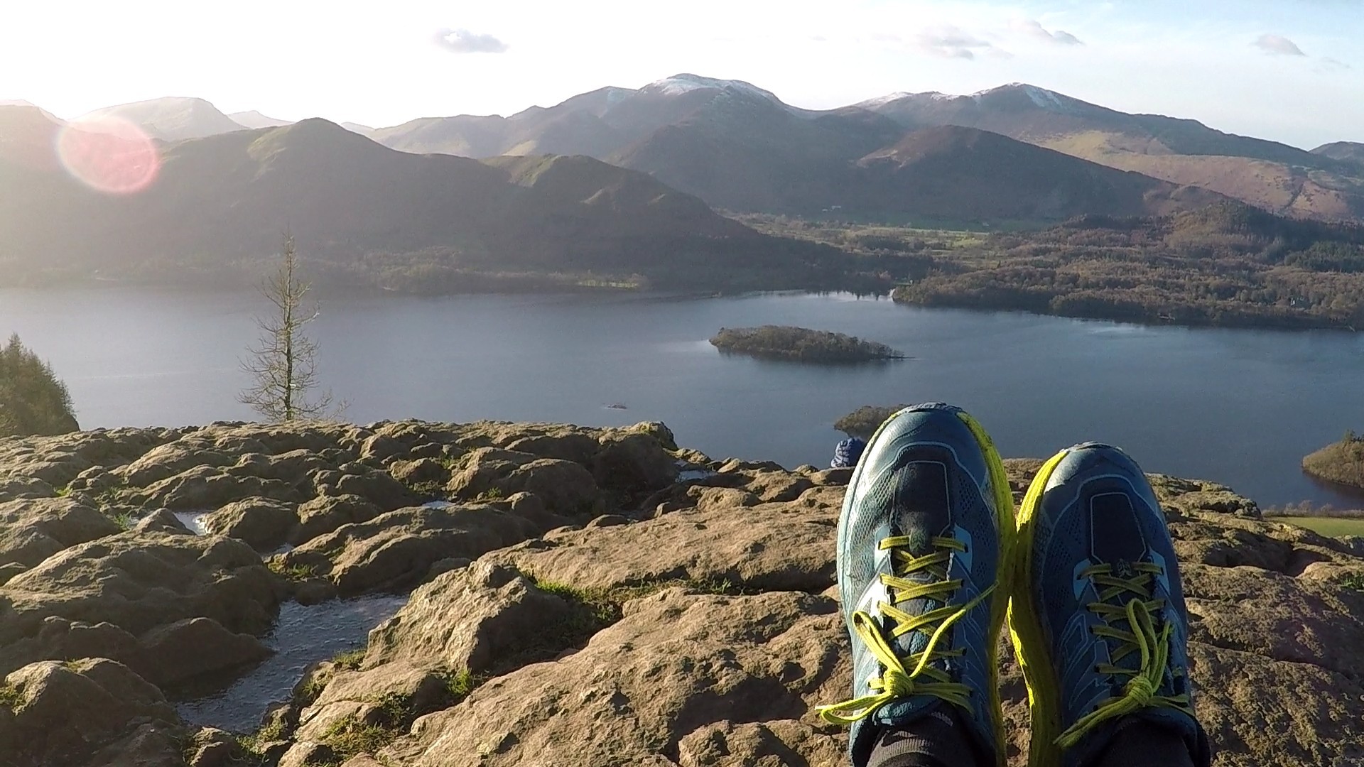
The view from my Dogsbody high hide in the Brecon Beacons this weekend

I have just spent a fantastic weekend in the Brecon Beacons where the Mountain Rescue Search Dogs England team joined up with the Search and Rescue Dog Association Wales for an intense weekend of training with dogs and handlers being put through their paces from early learning in puppy class to the anxious assessment ‘exams’ for those ready to qualify as Operational Search Dog teams.

The new recruits soon grow into their roles

The weather generously provided practise conditions of almost every type often challenging for trainers, handlers and dogsbodies alike but the dogs, as always, take it completely in their stride and training is just all a brilliant game of winning their favourite toy.

The Dogsbodies, affectionately known as ‘bodies’ provide an essential part in training, giving the dog teams a target to search for as the dogs follow ‘air scent’ to learn how to find people lost, missing or injured in the outdoors. The handlers role is to coordinate the search, working with their dog to cover huge search areas efficiently, assessing wind conditions and terrain to cover the ground in a way that maximises the dogs opportunity to pick up a scent quickly. It’s very much a team effort and the bond and relationship between dog and handler is all important, ultimately defining their success as a team.

Always time for a spot of larking about – AKA all important team building!

But back to those ‘bodies’! Many volunteers are friends or partners of Mountain Rescue team members but others do it for ‘fun’ and the brilliant camaraderie amongst the teams make for a great social side too. On the quieter side, hiding in the hills and forests is also a great way to see wildlife and nature literally up close (and sometimes other, more bizarre goings on?!) in a way that you would not on a usual day in the hills. Wrapped up in a sleeping bag and cosy in your bivvy it’s a treat to just be still and soak in the scenery. At various intervals, of course, a dog will find you and then you get to play a few minutes of ‘catch’ , ‘fetch’ or ‘tug of war’ with a very excited dog. With dogs in earlier stages of training the body’s role can be much more interactive with considerable leaping up and down and running about required!

The dogs goes bonkers for their favourite toys at the ‘reward’ playtime

The teams can never have too many ‘bodies’ so if you are over 18 and this sounds like a way you might enjoy spending a soggy Saturday morning google your local Mountain Rescue Team or Lowland Rescue Team to find Search Dog teams near you who’ll give you the scoop (not literally – that is not part of the job description!). There are no specific skills required – you don’t even need a particular proclivity to camouflage wear! – just competence in the outdoors and it’s definitely important to love dogs as you may be inflicted with plenty of spaniel trampling or collie kisses. A sense of humour is a good strength! If you can only join in occasionally that’s fine too. You’ll be contributing to mountain safety and the wonderful tradition of #MountainRescue we should all be very proud of. Click here for more info about getting involved.

Training can be challenging and physical but all set in stunning locations

How often do you take the time to just lie down and watch the clouds go by?

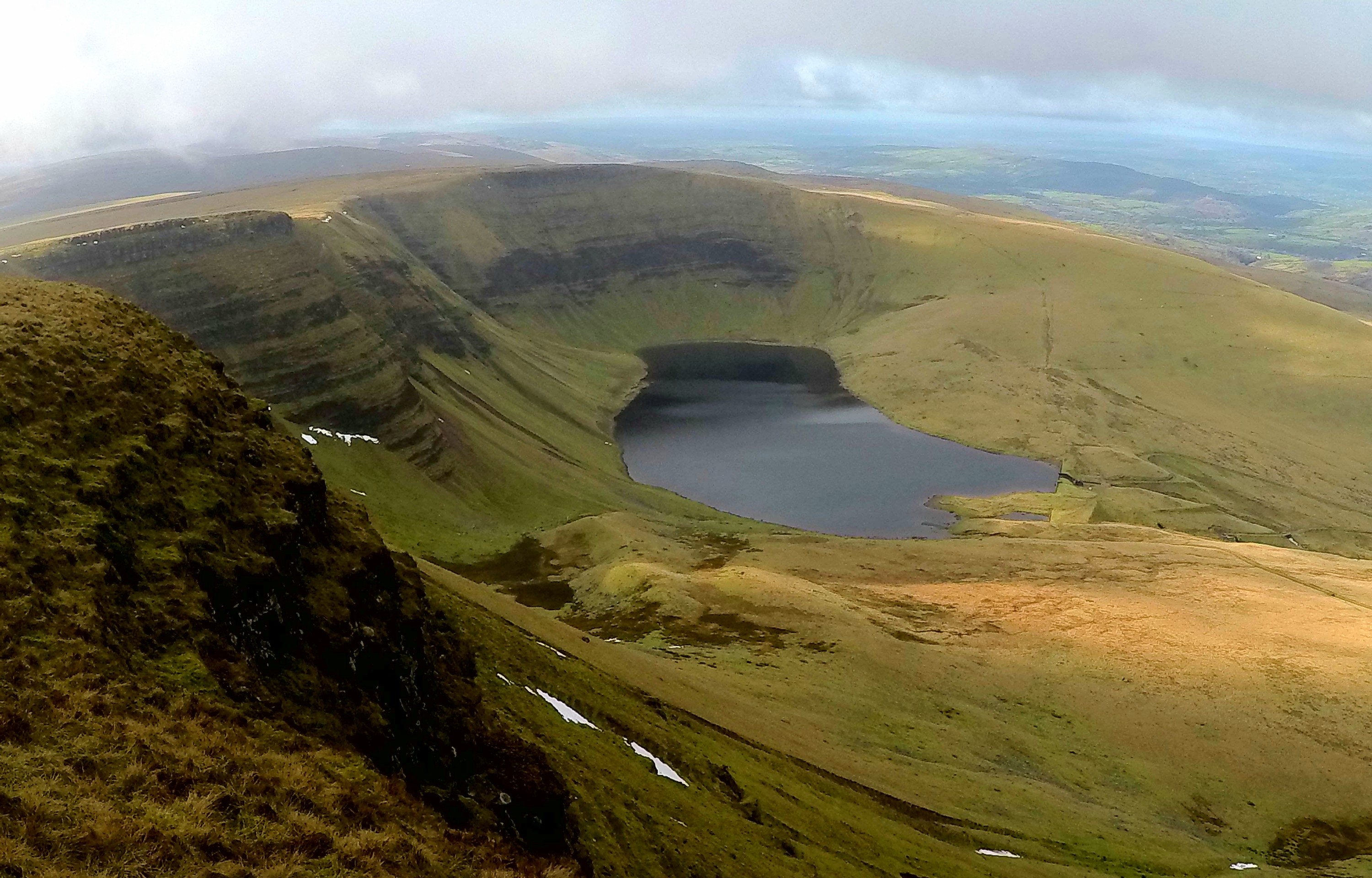
Celebrating a successful weekend – Philippa and Search Dog George pass their assessments.

The dogs are all pets first and part of their handlers family. One of the wonderful things about being a dogsbody is seeing them progress from their first ‘sit-stay’ as adorable pups to qualification day as a confident, reliable team being placed on the Operational list ready for potentially life-saving call out duty. This weekend saw handler Philippa Lewis and Search Dog George of SARDA South Wales pass their assessment to Operational grade and handler Tony High of Teesdale and Weardale Search and Mountain Rescue Team and Search Dog Chief complete the journey to qualify to Operational grade. Chief and Tony are strong characters with an equally strong bond and are sure to be a very successful team as the real work now begins.

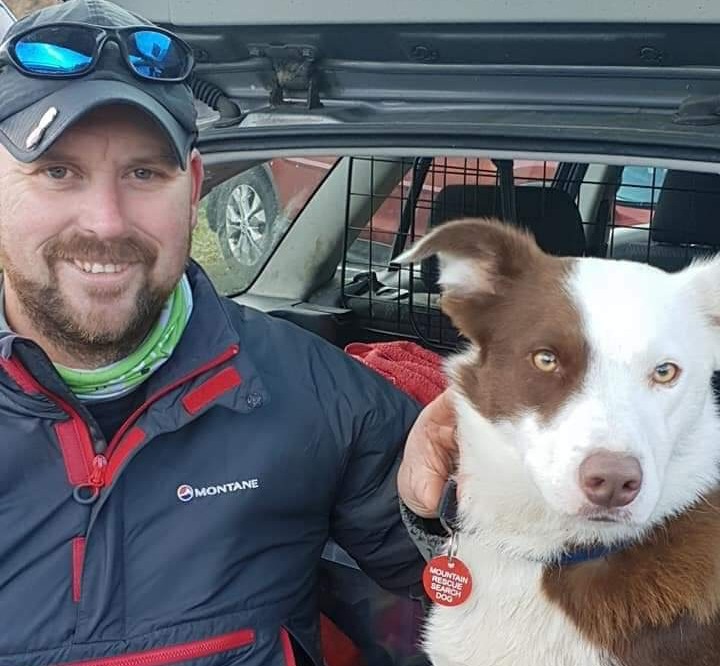
Congrats to Tony High and Search Dog Chief passing their assessments this weekend to become an Operational Search Dog team.

It’s a real privilege for me to join in with these training meets and it also reminds me why I am fundraising for these dedicated and committed individuals and their teams. Mountain Rescue members already give so much of their lives voluntarily to provide a safer environment in the outdoors for all of us and really do save lives in many environments and scenarios as well as providing regular and invaluable assistance to the emergency services.

Follow regular updates to my 1000 MOUNTAIN CHALLENGE here 👍🏃‍♀️⛰

There are currently close to 60 Search Dogs either on the callout list or coming through training and it costs £35,000 a year to train and keep all these volunteer dog teams in action.*

A £2 donation can keep a team in action today so please visit the

RunningtheSummits VirginMoneyGiving Page or the RunningtheSummits JustGiving Page

and become part of the family🐾🐶🐾

Thanks for reading and Happy Trails😊👣

Follow regular updates to my 1000 MOUNTAIN CHALLENGE here 👍🏃‍♀️⛰

Photos are my own or courtesy of MRSDA England and SARDA South Wales * figures from MRSDA England

Wicklow Diaries Part 4

Day 7 – There’s a reason Ireland is so green

A very fine morning enjoying the comfort of the Glenmalure Hostel gardens

As we sat sipping coffee in the warm sunlit garden of Glenmalure Hostel it was easy to imagine a glorious day of weather ahead, but by now I knew better. The sun may be shining in the valley in the early hours but I knew things could be quite different on the ridge and sure enough after bidding farewell to my new found friends following a fabulous breakfast of fresh pancakes I began the climb back up the trail to Black Banks Pass and could already see dark clouds closing in.

I hoped to reach four mountains today strung out over more than 20miles of rough terrain including a long ‘out and back’ to Lobawn. I had considered cutting this from the route in order to make it back to Dublin on time but after a good night’s rest I was feeling confident that I could make the distance today. In fact things went pretty well out to that summit, it was not yet raining and after some peat hag obstacle negotiation there was something of a faint path to follow and I made some good early mileage. I could clearly see a wide band of heavy rain heading my way and on the way back down reluctantly pulled out my rain gear again before it hit.

Possibly the wettest week of my outdoor life!

It continued like this for a while – heavy downpour followed by short, windy dry spell until the cloud dropped once again, visibility faded and the wind and rain became more persistent. I’ve long since learned that short cuts are rarely quicker or easier but decided to drop down into the valley to avoid a long route around the ridge and steep descent. It was slow going and very wet but I was rewarded with stumbling into the largest group of deer I had yet seen in these mountains. Sika deer were introduced to the Powerscourt Estate in Co. Wicklow in 1859 and they soon escaped and started to breed with the closely related native Red deer. Most of the deer are now likely hybrid as there are very few Red Deer remaining. I marvelled at their grace and easy agility as their barks and whistles alerted the herd to take flight up the gully onto the ridge. I could only wish I was able to move with such flow through these hills. How impossibly heavy and cumbersome I felt in comparison. I watched as they kept pausing to look back at me but ultimately decided to create a good distance between us.

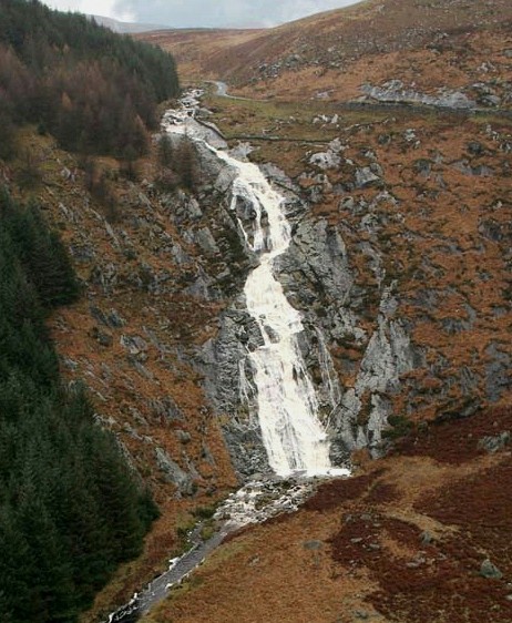
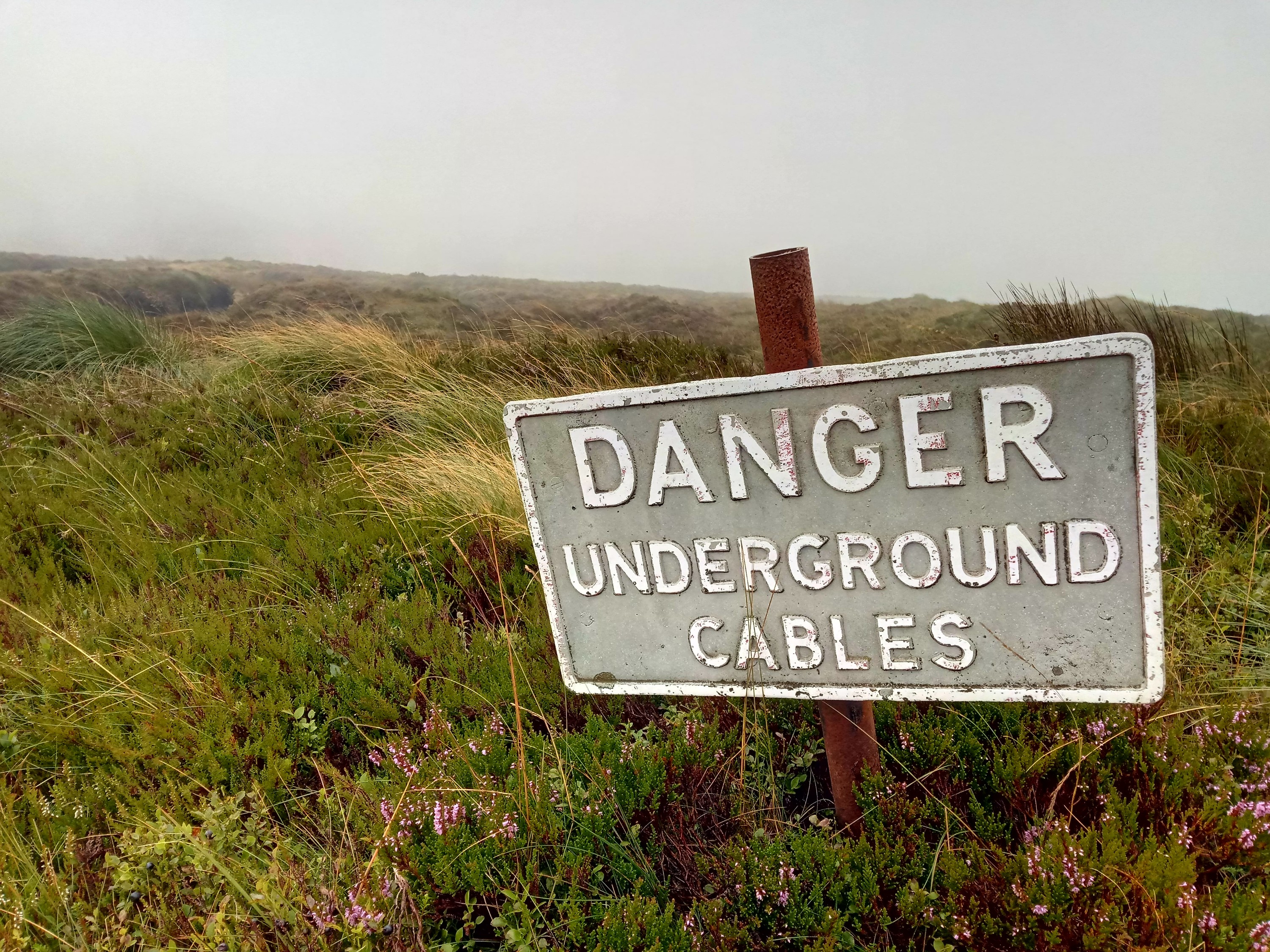
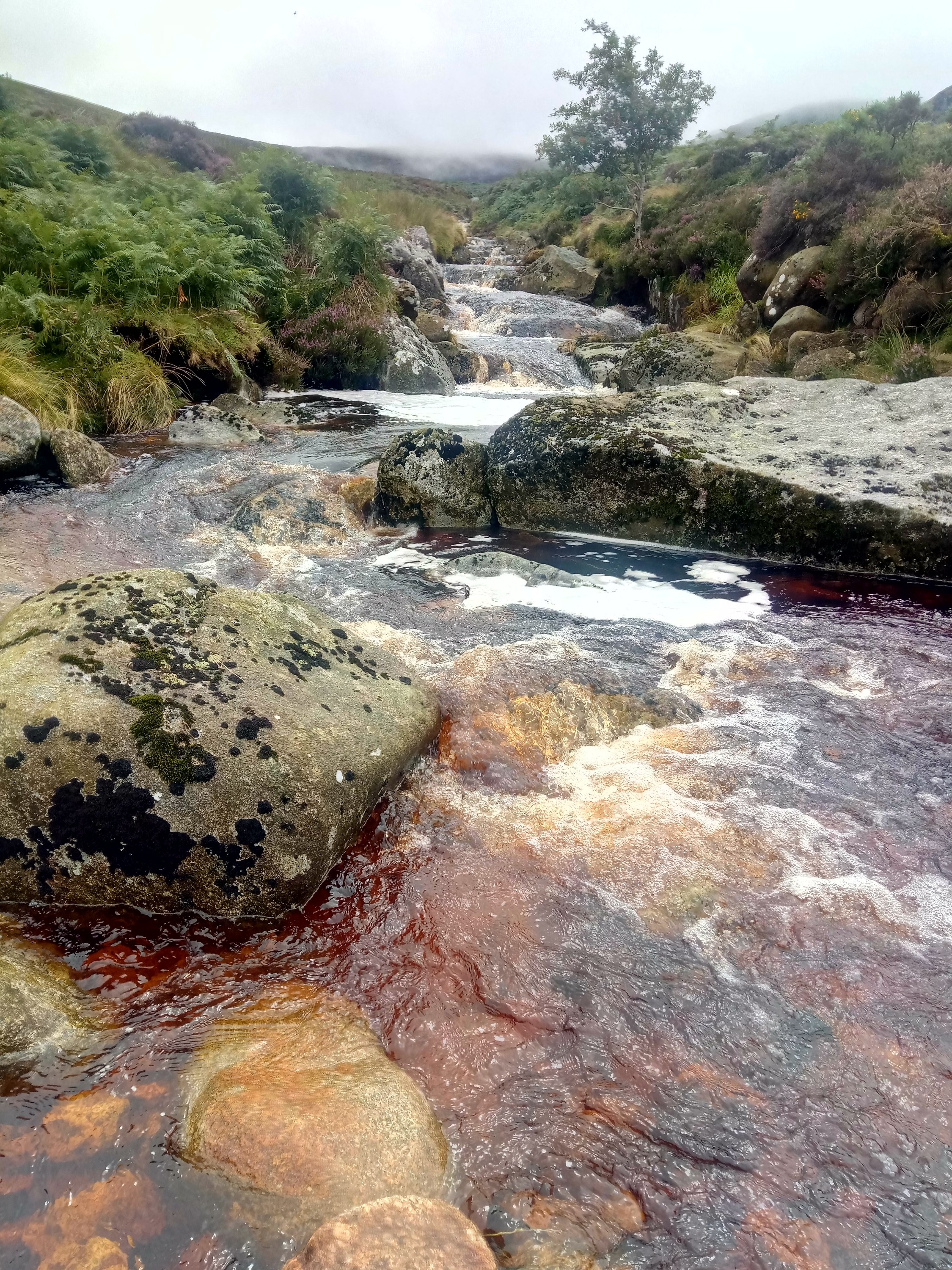
This short cut left me the wrong side of a ‘stream’ and I had a worrying sense of deja-vu when the cloud cleared enough to catch a glimpse of waterfalls coming off the hills and the loud roar of fast moving water. It was certainly bigger and trickier than I expected but after about ten minutes of scouting about for a good place to cross I picked a safe way over around the rocks, no more than knee deep and was back on a path!

On the other side of the valley my route up the next mountain was a bit, shall we say, ‘unconfirmed’, on the map. Leaving a road I entered a forestry track where I got the feeling hill goers weren’t really welcome. My onward path turned quickly off the track and continued promisingly upward in a negotiable line between the trees where others had clearly passed, albeit not often. Crossing the track again much higher up my path continued for a short way then fizzled out to nothing but a tight clump of trees. Pushing through to see if there was any onward route it was clear I had reached the end of the line. I returned to the track and reluctant to retrace all my uphill efforts right back down again followed the forestry track up in the vain hope it might pop out onto the open hillside. I wasn’t too confident as the map showed it just coming to an abrupt end in the forest and shortly that’s exactly what it did.

At that moment I spotted another deer just ahead of me and was impressed that for the first time the deer had not seen me first. That was until three others leapt from the trees, covered the track in one bound and leapt effortlessly up a three metre high cutting and back into the dense tangle of trees. For sure, they had seen me coming! I couldn’t fathom how they so easily melted into the trees, the branches and undergrowth were so thick and tightly packed it barely seemed possible for anything to squeeze through let alone such a large animal. The open hillside was less than 100 metres through those trees but there was no way I could even wriggle through on my elbows so I started back down eagerly searching for some space through the dense forest. Eventually I came to a small area that had been recently felled and a churned up machinery track wove up it to reach open land and the National Park boundary. Again I was aware I shouldn’t really be on this spot and eager to get back on National Park land I slipped and slid up the muddy channel as quickly as I could to tumble over a low battered fence onto the moor for once feeling extremely grateful to be back on that boggy rough heathery and pathless terrain which was far more accommodating by comparison.

Wet feet guaranteed!

Gaining height the weather deteriorated badly and I was soon being blasted by strong side winds and sheets of very heavy rain all the way to the summit which then required a bit of bold negotiation in thick clag over a featureless and peat bog plateau. This would be the shape of things for the next few hours as I had to hold my nerve to navigate in some of the worst visibility so far over 5 miles of featureless moorland. Keeping the wind at my back I followed a bearing through the murk hoping not to come across too many peat hag bogs that would try to throw me off course in this eerily gloomy landscape.

The small direction post was the only feature to navigate to on a misty Moanbane summit

I was concentrating so hard I barely noticed the heavy sheets of whipping rain that intermittently caught up and overtook me. Finally over the wide expanse of Billy Byrnes’ Pass I dropped to lower ground and as evening crept up gaps broke in the cloud to allow a glimpse of a vast shimmering sheet of grey-silver far below – Poulaphouca Reservoir, known locally at Blessington Lake. I scoped out some wet ground that was slightly less wet than all the other wet ground and the weather was kind enough to stop raining for just enough time to get my tent up, shake off my layers and crawl inside.

I even had enough time to get the stove going to fill a flask with hot tea and cook my three minute moroccan cous cous meal. A brief but beautiful cloudy view of tomorrow mornings’ and the final mountains of my journey faced me across the valley before the cloud gently closed in again and I closed up the tent zips as the first drops of rain began to fall.

Day 8 – Dublin bound for a drop of the black stuff!

Final Day in the Wicklow Mountains

It was 46 kilometres and four final mountains to the end of my plotted trail back to Dublin which I had to reach today as it was time to return to work. I suspected the terrain over these final hills would be a little easier going than that in the heart of the National Park and now I had eaten most of the food in my pack it was weighing in a few kilos lighter. It was still an ambitious distance and I was pretty tired from the tough week but I was lucky to meet Avril, a very kind lady from Larack, herself a keen hill-goer who insisted on giving me a lift along the long road section of my route to the foot of Seefin, a popular summit with an ancient Passage Tomb burial chamber situated at the top.

The Passage Tomb on Seefin

Though I did originally want to complete the entire circuit on foot I had already had to make a few adjustments due to delays and so wasn’t feeling so purist about these road miles. I was there, after all, to summit the mountains so I happily accepted her offer and we zipped along the rural back lanes exchanging outdoor adventure stories and her tales of Wicklow life while I tried to apologise for the seriously rank smell that was by now a constant emanation from my wet feet. Before long we were wishing each other farewell and I stood at the bottom of a climb to Seefin summit now with a much more manageable 34 kilometres ahead, just over 21 old-school miles!

A fantastic spot by the river for an early lunch cook-up.

Today turned out to be the best weather day of the entire adventure. Sunny spells and not a single shower hit me – it felt as though the mountains were finally rewarding me with a show of glorious beauty for all my tenacity battling through everything they had thrown at me over the week. It was certainly a perfect way to finish the journey with long views back over the wild mountains I had traversed. I tip-toed over a couple of easy stream crossings, enjoyed the riotous colour of swathes of hillside heather and followed well used trails over these final mountains – I even saw five other people out in the hills today, a veritable crowd by previous standards!

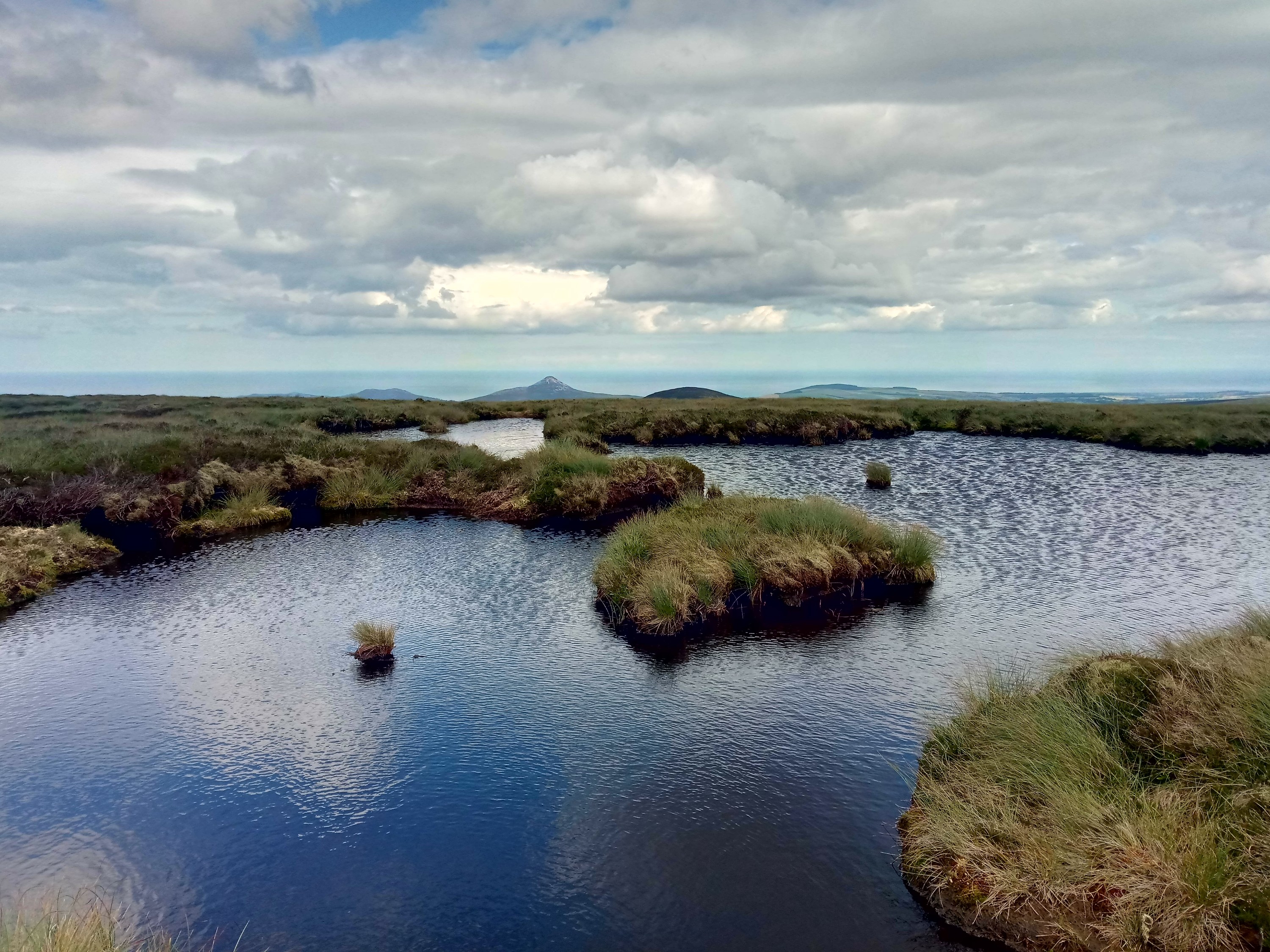
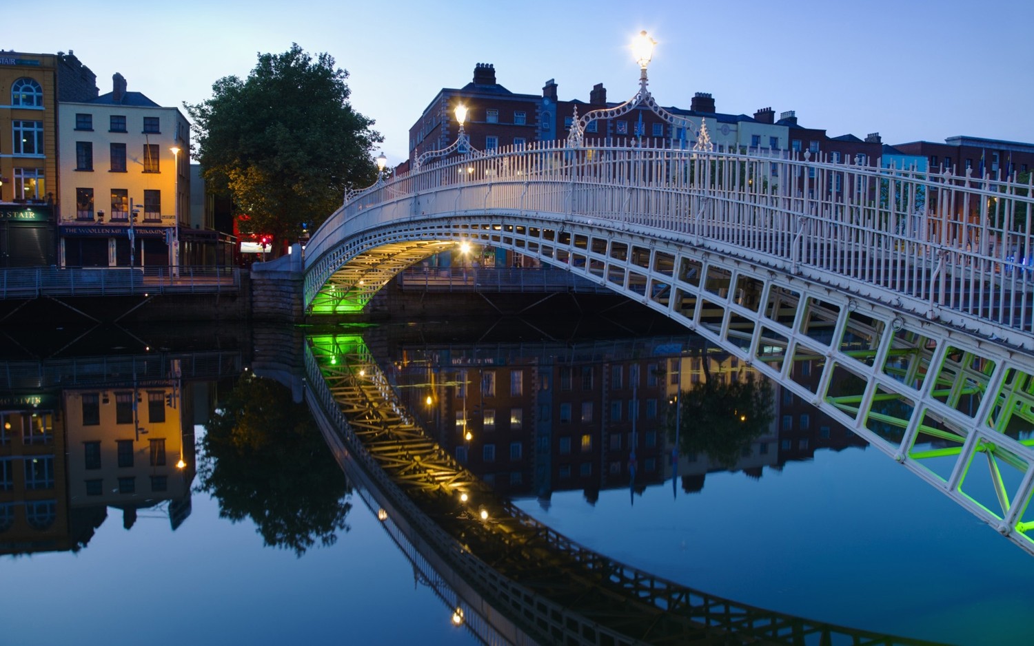
Reaching Corrig Mountain and Seahan the entire city of Dublin was laid out below and it was quite a contrast to look north over the vast developments of the city and its surrounds and then glance back over my shoulder to the miles and miles of wild, deserted moorlands through which I had passed.
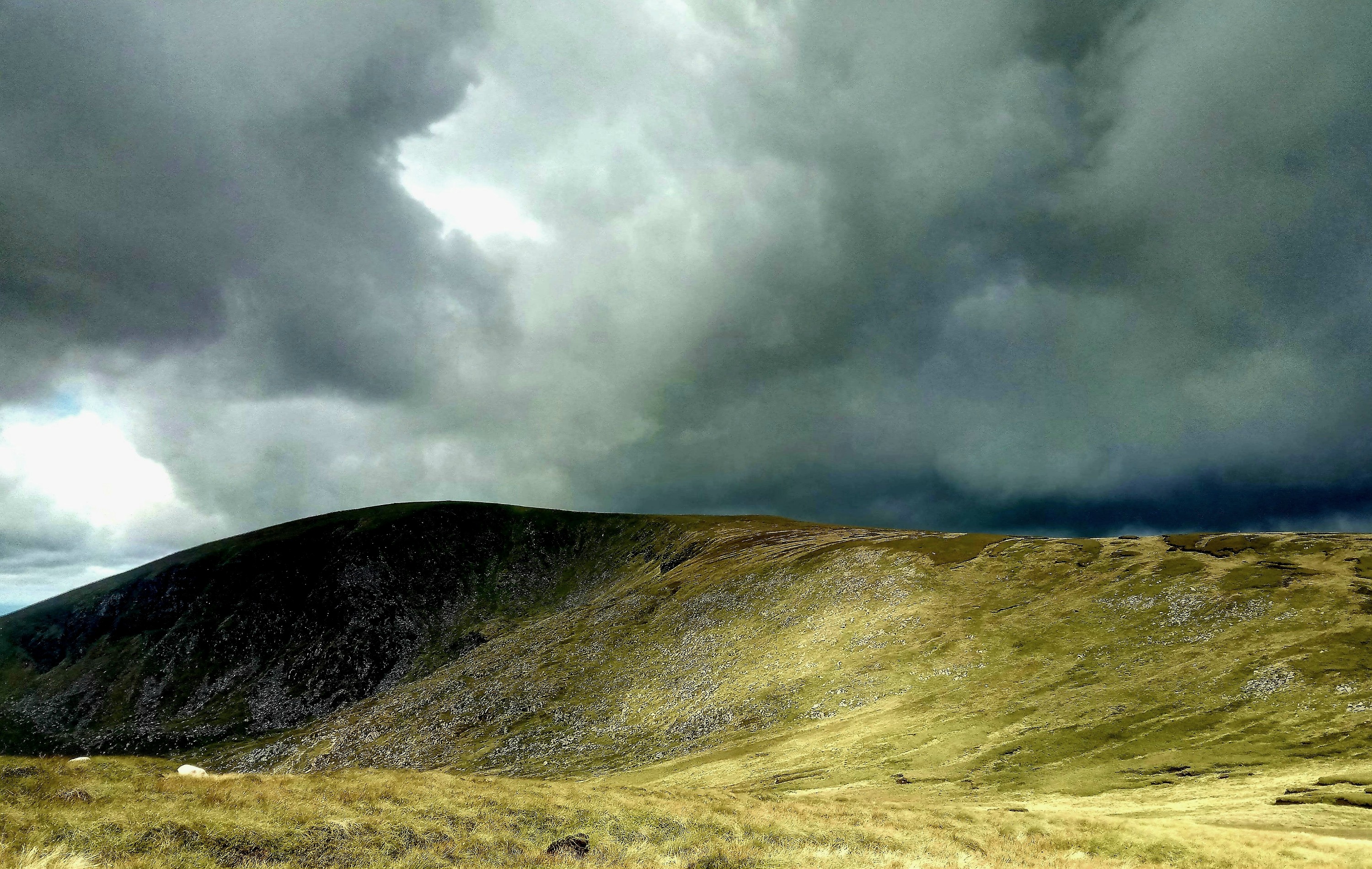
img_20190815_110001_8762687113.jpg

A long view toward Dublin Bay

It would be odd to return to the frenetic pace and noise of the city and I really wished I had more time to pitch up my tent and watch the bay from afar, especially as it was now, suddenly, brilliant wild camping weather! But all that was left was the long downhill to the outskirts, suburbs and increasingly urban landscape below and a couple of hours later I was sat in a pub celebrating my ‘Wicklow Round’ with the obligatory glass of Guinness.

A VERY welcome celebratory Guiness!

I had covered 208km (130miles) on foot with 7600m of elevation gain and loss and managed to ‘bag’ 35 of the 39 mountains. Considering how testing the week had been I was pretty happy with the result and the four elusive mountains that remained meant that I would soon return to this beautiful region, after all, surely the weather couldn’t ever be any worse!?

Leaving the wonderful, wild, Wicklows for now…..but I’ll definitely be back!

During my #RunningtheSummits challenge I hope to summit 1000 Mountains of the UK and Ireland – you can vicariously join the adventure at Running the Summits on Facebook with regular posts about fantastic routes (and #type2fun days😉) in our fabulous hills.

Happy trails😁👣

Wicklow Diaries Part Three

Day 5 – The Glendalough Skyline

My dramatic relationship with the weather would not be over yet but for this day at least I would have a reprieve. With most my gear drying out in the hostel I took the advantage to create a circular loop of the mountain summits of the Glendalough skyline. With seven mountain summits over a distance of 29km this would be a good catch up on time lost in the Tonalagee struggle. It also meant I could travel light and do some real running in these hills. The mountain weather forecast I had been following seemed to be remarkably accurate at predicting weather once it had passed but a little more vague when it came to future weather forecasting. In fact it seemed to be updated several times a day to reflect what the weather was actually doing rather than accurately providing any kind of advance ‘heads-up’. If the weather forecast for ‘tomorrow’ didn’t transpire it would be reforecast for the following ‘tomorrow’. By this point the best thing seemed to be just to look at the sky and generally expect to get wet at some point.

Incoming shower…

Today looked like a mix of sun, cloud and heavy showers which was a massive improvement on the story so far and after a moody start it turned out to be a great circuit, with only the section in the middle full of the peat hag assault courses I was becoming accustomed to. With wonderful views of the sea, coastline and valley below it seemed a shame only to see two other people in the mountains all day. When I joined the Wicklow Way back down to Glendalough and reached the valley floor with its jaw dropping views however, I discovered that’s where EVERYBODY was.

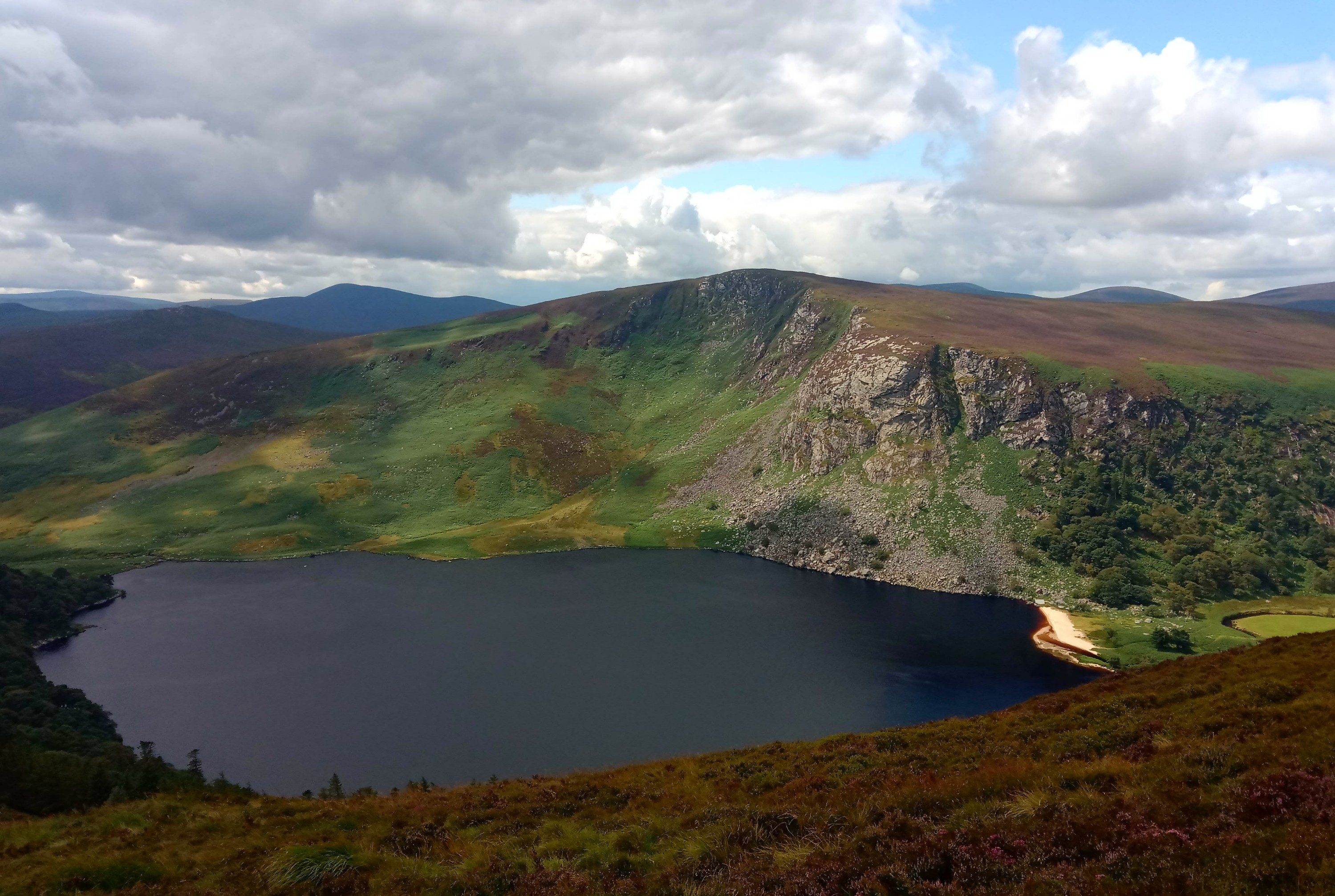
The very photogenic Glendalough valley

This stunning glacial ‘Valley of the Two Lakes’ is very famous and extremely popular with an estimated one million visitors a year to the valley and particularly busy on an August Sunday afternoon. The contrast between the solitude of the hills and the bustling crowds in the valley was entirely overwhelming and several smartly dressed, camera toting visitors tip-toeing along the edge of the lake gave me quite a wide berth as I ran down the hill soaked with sweat and walked straight into the cooling waters of the lake with my shoes still on! “Clearly a madwomen” they were probably thinking. It’s true that the more time I spend outdoors in all the elements the more, almost feral I become. Usual inhibitions seem to fall away as I become relaxed and at home in my outdoor surroundings and I sometimes have to remind myself that things I might do in the mountains are just not socially acceptable when strolling around Tesco!

Day 6 – Big ‘ol mountain day and the (almost) forgotten valley of Glenmalure

After a more than arguably generous day yesterday, todays skies promised much the same – a bit of sun, a lot of cloud and those ever present highly localised furious downpours. At least you could see them coming from the mountain ridge and be prepared for impact! After losing so much time with the river crossing shenanigans I would have to cut out four outlying mountains in order to complete my Wicklow Round in the time remaining. Frustrating, but it meant it would possible to complete the route with three big days over 15 mountains. And the mountains would still be there another time! Today included Lugnaquilla, the highest mountain in Ireland outside of Kerry and yet the straightforward grassy plateau made this possibly the easiest summit to reach during my whole time in the Wicklow Mountains despite the nasty weather that hit as I was heading up.

 Lugnaquilla provided an easy and gentle summit despite looking uninviting from below!

After another seven summit day over 29km with 1500m of elevation I crossed a stream – easy enough on this occasion and found a decent camping spot sheltered though still fairly waterlogged. However, I was a bit torn because close by in the valley bottom was Glenmalure Hostel, a simple mountain lodge described as ‘basic’ on account of having no running water, electricity or indoor plumbing of the toilet variety. It was really a cosy bothy where evenings would be spent in candlelit conversation around a roaring log fire and was quite famed for a warm welcome and its idyllic location…oh, and of course, its resident ghost, ‘Scary Mary’ who apparently is a kleptomaniac for cosmetic accessories!?

The welcoming cosy hearth of the Glenmalure Hostel…..and no sign of ‘Scary Mary’

The valley has seen many battles over the centuries and some of the trails are said to be haunted by marching ghosts of deceased soldiers. Despite the spooky stories I felt it would be a shame to miss out on visiting this legendary place. It was just 4km down into the valley although that would mean a 4km climb back up in the morning, but it seemed well worth it and I could hang up my wet things again overnight.

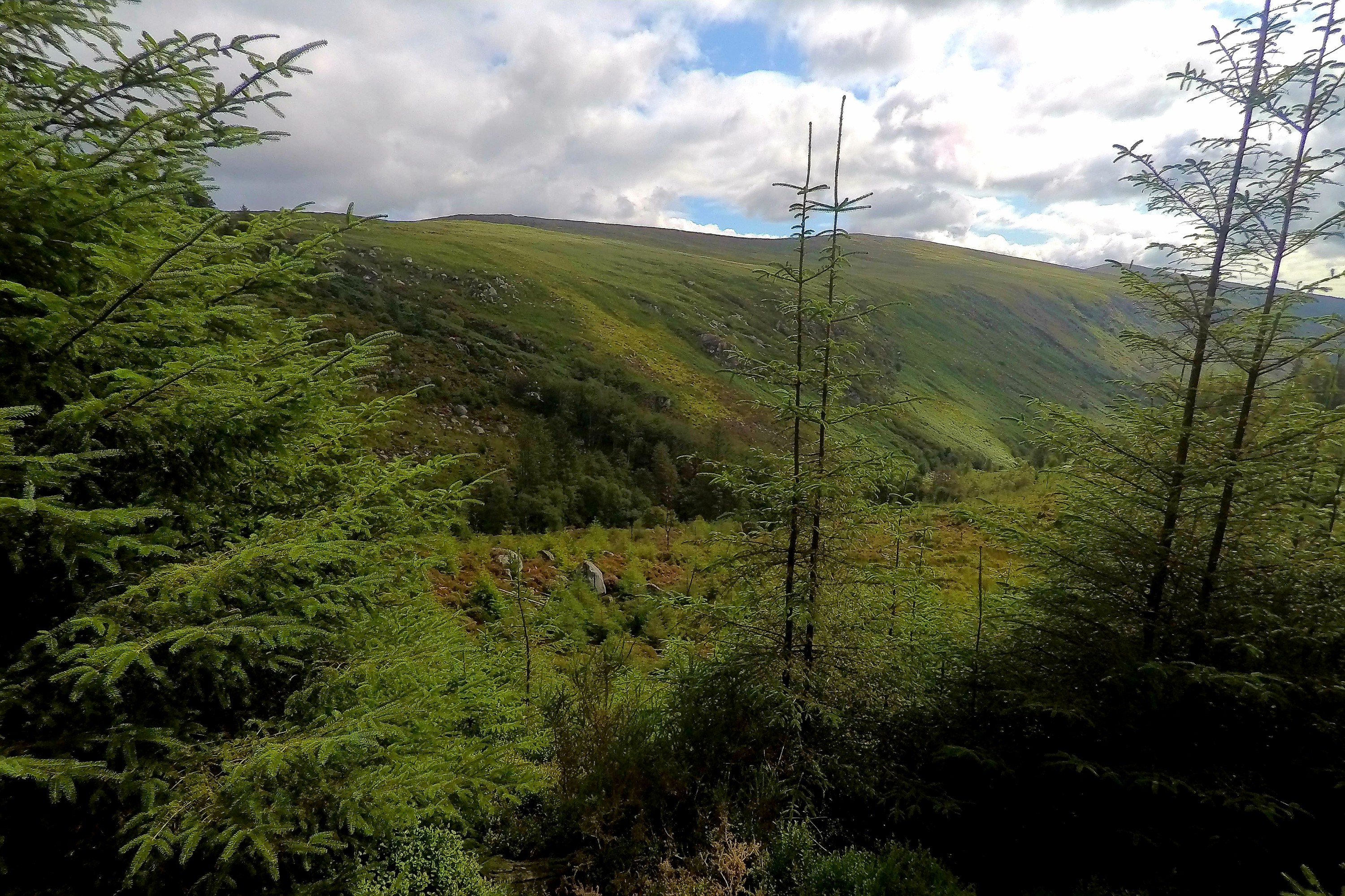
Down into the peaceful Glenmalure valley

I arrived just in time for dinner which was a very unexpected and welcome surprise. The hostel is cared for by volunteer wardens and as well as a wonderful welcome they prepare delicious hot meals. It was a great evening as we put the world to rights over a glass of wine or two by the fire as the river raged by outside the window. During the previous rough spell of weather the track over the river here had been impassable too and they had been unable to get out for a couple of days. Seemed the storm had caught many people out. Not a bad place to be ‘trapped’ though. After a hearty meal, great conversation, feet warmed in front of the fire and that glass of wine I had the best sleep of this whole adventure!

The Wicklow Diaries – Part Two

PART TWO

Day 3 – The Epic…

After the maelstrom of the previous night I awoke, although that does suggest I was sleeping!?, into a very soggy half light of morning. The rain was solidly falling in sheets, cloud was down around me and there was considerable wet ‘seepage’ into the tent – hardly surprising when every spot you stood saw your feet sinking a few centimetres into the sodden, wet ground. It was not exactly the scene of an idyllic Instagram‘able wild camping trip! (As I really didn’t get many meaningful pictures of these two days some of the following photos are from the previous day which did allow me to briefly see the beauty of these mountains!)

Brighter times the previous day!

I packed up quickly in the rain, impressed again at how the tent had seemed to take the conditions in it’s stride though not sure the same could be said for me. My goal for now was to get to the road, climb the mountain on the other side of the valley and reach the shelter above Glendalough valley. With visibility poor I used the line of a fence to make some progress upward. It was hard going as there was no path and the terrain was steep with thick, deep heather and rocks and everything was wet and slippery. All too soon I had to navigate across the open hillside to get back onto the ridge for the climb to Tonelagee, the provinces third highest summit. Emerging from the sheltered side of the ridge all hell seemed to break loose approaching the summit plateau. Gale forces winds pummelled me and I had difficulty staying on my feet. The wind whipped the rain sharply, lashing it painfully against my face. Tonelagee or Tóin le Gaoith literally translates as ‘backside to the wind’ and as soon as I had reached the summit trig pillar I took the name as sensible advice, turned away from the onslaught and hurriedly found my route off the top.
I had been looking forward to stunning views of the heart shaped lake of Lough Ouler below but there was only thick, misty cloud swirling in the void below, a smoking basin below a precipitous drop. I had been so focused on reaching the small road at the foot of the valley and distracted by the intensity of the weather I had almost forgotten about the small matter of a river crossing between me, the road and my onward route. The map showed a definite crossing place and suggested another (albeit without a bridge of any kind) but it had been raining heavily for over eighteen hours by the time I reached it and the Glenmacnass river was now in spate, churning wild white-water over the rocks between fast moving deep channels that appeared to be easily chest height in places. I would not be crossing so easily!

Stopped in my tracks!

It was slightly surreal to come off the mountain and see the road and small parking area right there, barely ten metres from where I stood but with no way to reach it. To the left stood a forest and the map showed some buildings and potentially a bridge over the river about 2km downstream. The forest was not too dense and although quite flooded in places I could make relatively easy progress through it. However, I very soon came to an abrupt halt at the huge Glenmacnass Waterfall head as it raged over a rocky precipice and vanished, out of sight, to the valley far below. I had completely underestimated the tight band of contour lines on the map which were realised here as a long, steep drop to the flat land of the valley and my potential escape route. Peering over the edge there was a short section of smooth rock I could have climbed down but with no way of knowing exactly what was beyond and considering I would have some major difficulty getting back up this rock, particularly with my heavy pack I reluctantly wrote off this route and turned to pick my way back through the trees.

The Glenmacnass Waterfall – even on a calm day like this I doubt I would be attempting the climb down!

My next plan was to follow the river upstream where I hoped it would eventually be crossable. This was a hard slog and there were many tributaries that had sprung up, all pouring into the river from the mountainside and they all had to be crossed, often involving lengthy clambers inward to higher ground to find safe places to get over. Eventually I reached the section where the river split into two and was able to cross one part but the main torrent didn’t seem to let up at all. I caught a glimpse of another huge waterfall coming over the edge of a sheer corrie wall which was clearly feeding into the river. It was obvious there would be no way to safely get over this river and any onward route would involve a very steep climb up the corrie sides to get to the top of that waterfall. This was not really a feasible option, it was too late in the day to end up back on top of a mountain in the conditions and the climb could be fairly treacherous as it had been raining heavily non-stop the whole day. I made the decision to retrace my steps immediately in order to get past the tributaries before they got worse and potentially impassable which would have left me cut off and stranded. After five hours battling along this river I made camp for the night on slightly higher ground to rest and think about the other escape options. Again I managed to find some shelter from the worst of the wind, although all the ground was well waterlogged so pitched over a patch of heather to try to stay above the water. One advantage of no one being around meant I could freely strip off all my dripping wet clothes and leave them outside before diving into the tent to warm up. My impromptu pitch was quite sloping and I had to literally hook myself over a thick, gnarly heather stalk that was sticking up to avoid constantly sliding off the air mat but I was warm and relatively dry inside so long as I kept away from the water pooling in the corners of the tent so hunkered down for another wild night on the side of the mountain.

Looking and feeling pretty frazzled after unsuccessful hours trying to cross the river!

*This day brought home to me the importance of having the right gear and level of experience for your chosen outdoors activities. I was certainly pushed outside my comfort zone but at no time felt scared or overly concerned, a good part due to the fact I was carrying food for a week, shelter and a set of dry thermals wrapped in 4 layers of dry bags. There were several ‘escape’ routes so it was certain one would pan out and even if not I could have hung out for several days if need be until conditions improved, it would have been uncomfortable and pretty miserable but I would have been fine and at least would have no problems finding water!

Day 4 – Escape from Tonelagee Mountain…

Perhaps unsurprisingly it was raining still as daylight broke. I was surrounded by sheep who, quite frankly, were all looking a bit miffed with me for spending the night on their favourite patch, the only tiny square of non-flooded ground to be had as far as the eye could see. It was the first time I have noticed that very wet sheep shake themselves dry in exactly the same way as dogs do!? Fortunately they hadn’t chewed through my tent in retaliation and despite the little pools of water in the corners it had held up excellently once again. A bit of cold food and an uncomfortable nights rest constantly shimmying back up the tent after continually becoming unhooked from the pokey heather stalk I had ‘hooked’ my hip over had given me plenty of time for problem solving and I had devised a plan! The only other potential escape route on this side of the mountain was short and would get me back on track but with it’s own potentially problematic water crossing and a couple of areas of ‘unknown’ I decided not to even bother. The most sensible option was clearly to climb back over the mountain and get off the other side. I had avoided this option as, (a) I felt a bit lazy about climbing back up and over the three summits I had already climbed the day before and (b) I didn’t fancy revisiting the insane wind conditions up there – I guess the second excuse was a valid argument! From the summit of Tonelagee there were three options – a very direct route straight down off the mountain to the road – my clever use of maths in relation to contours and height lost over distance gave me the calculated result of “it’s a bit steep” and I dismissed this as steep was more tricky with the heavy pack and would undoubtedly be very slippery and possible a near vertical mud slick by now, not to mention it would be straight into the gale force wind. The second option was to follow the south east ridge for five miles towards Glendalough. This was my initial choice but not knowing what surprises that five mile ridge might contain and given that it would be fully exposed and the cloud was down with very limited visibility I wimped out and went for the third option which was to retrace the way I had come yesterday and use the forestry track ‘escape route’ I had identified on my previous camp. This was further and meant some seven miles of hoofing it along the road to get back on track but I knew the route, there were no hidden surprises and no watercourses potentially out of control. There was a vague possibility that a bridge before the road could have been damaged or washed away but I figured some things were just beyond my control.

Plan made, I wrung out as much water as I could from my sopping clothes and put them back on (that was a particular joy!) It was still not going to be an easy day. I had a long steep climb back up and the wind was just as violent as the day before but at least once I got over Tonelagee plateau it would be behind me. There was a short, sketchy section to navigate over rough ground in very bad visibility to get to the forest and avoid dropping too far back into Barnacullian Bog but fortunately it only had a few small peat hags to negotiate. It was no small relief then when I finally hit the forestry track and started to believe I may actually get off this mountain today. Crossing the fully intact bridge and suddenly being spat out onto the road into a world of people whizzing by in their warm, dry cars was a bit surreal after literally seeing nobody for three days in the hills. I imagined in good weather there would have been far more hill-goers enjoying these mountains especially as it was technically summertime but they were probably all far too sensible to be wading about in these conditions.

On the long slog along the road I had time to think about what to do next, something I had put off, simply focusing on getting off the mountain before anything else. I really wanted to find somewhere to regroup, dry out all my wet gear and think about how get my ‘Wicklow Round’ back on course. It was bad timing that it was Saturday and I knew the very popular Glendalough Hostel was fully booked all weekend but I decided to give it a try and perhaps appeal to their sympathies to at least allow me to hang my stuff in their drying room for a few hours.Just a mile from the hostel a couple of ladies in a car stopped and insisted on giving me a lift down to the hostel. They had abandoned their own planned Saturday afternoon group walk along the St. Kevin’s Road due to a river stepping stone crossing being washed out and since it was still raining had decided to go to the pub instead.
Standing, dripping in my own slowly growing pool of water at the Glendalough Hostel reception they did indeed go above and beyond to help me out. Not only was I welcome to use the drying room and even take a wash for no charge they also promised to find me a bed somewhere. Personally, I was quite happy to put my sleeping mat down in the corner by the vending machine but this was a welcome opportunity to dry everything out, repack and study the maps to get this mountain challenge back on track and all accompanied with a luxurious supply of hot coffee!

I already missed the beautiful scenes from the first day I entered the Wicklows!

Despite everything that had happened over the last couple of days, with my kit on it’s way to being dried out and some warm food and drink inside me, it really wasn’t too long before I was itching to get back out there!

The Wicklow Diaries Part One – my first Irish Mountains.

In august an off-grid week of wild camping and mountain summitting in the desolate beauty Wicklow Mountains, my first foray into the Irish summits had all the makings of a fantastic adventure. Things certainly didn’t quite turn out as planned but nevertheless, an adventure it certainly was! Here is Part One of the four part drama!

I had plotted a 220km route looping from Dublin to include the 39 mountains in and around Wicklow National Park. With over 8500m of elevation gain, very rough terrain, notoriously fickle weather and the surprising remoteness of the area I looked forward to a week long, fast-packing, wild-camping adventure which in reality turned into the toughest mountain week I have experienced to date! It was definitely NOT a week of instagrammable camping sunsets but more of a special forces training expedition for one!

The Wicklow Diaries : Day 1 – The Calm Before…

Just under 10km through Dublin city from the Ha’Penny Bridge over the Liffey is Marlay Park, the official start point of the popular ‘Wicklow Way’, a 127km upland trail. I would dip in and out of a couple of small sections of this route as it doesn’t visit any summits but skirts mostly along the eastern side of the range.

Fuelled on a small Guinness I began following some easy paths of the Wicklow Way and soon the first mountains gave a hint of the nature of the terrain in this region. Though granite at their core these mountains are blanketed with peat bog which on many summits and cols form the impression of a ground that has been stretched and ripped resulting in boggy mazes of peat hags and channels.

It’s really surprising just how remote and desolate these mountains can be when you consider they can be reached on foot from the bustling capital city of Dublin in just a few hours. Heavy, intermittent rain showers were the order of the day but my only real challenge on this ‘warm up’ section was the uncustomary weight of my pack – a hefty 17kg – I was carrying a weeks food as my route would not pass any place to restock after the second day. This was quite something to contemplate hauling up and over 39 mountains but at least it would gradually get lighter as I munched my way through the supplies!

Day 2 – Closing in….

Setting off, my pack must have easily been 500g lighter after last night’s dinner and a hearty porridge breakfast! An ambitious 20 mile route over 10 Mountains was the plan and I made good ground through the morning, even dumping that monster pack halfway up a hill for a quick ‘out and back’ on Kippure – after all, (a)there was nobody around and (b)if anyway did try to hoof off with it they would not have been making a very fast escape under that load so I was confident I could give good chase!

After six summits I was a bit behind schedule having been slowed by the bogs and was yet to cross Barnacullian Bog – an expanse of peat bog generously described in guidebooks as “complicated ground”. This desolate landscape is an obstacle maze of peat hag islands, black holes and channels deep enough to be described as crevasses, all ready to swallow the unsuspecting hill goer.

Distracted by the task of navigating over the saddle to begin the climb to my last three mountains I had barely noticed the bad weather closing in and thick dark clouds dropping to smother the mountains as the wind began to rise. Heavy weather and high winds were forecasted but not until the following day and I had been planning sensible shelter for the Friday night but this was 24 hours early and suddenly looking grim. It was 6pm and at the speed I was making it would take some time to get over the next three mountains and down to more sheltered ground. Not knowing the terrain ahead and with Tonelagee summit looking less inviting by the second I made the decision to start scouting out a camping spot amidst all the bog. Dropping down off the main ridge in the lee of the increasing winds I found a pretty good spot sheltered by some large rocks and on well drained ground. Putting up the tent in double quick time I just got everything thrown inside including myself before the downpour began.

And so began a very long night as my tent was tested for the first time in torrential rains, high gusting winds and then to my absolute horror, a thunder and lightning storm. The lightning was an unexpected and un-forecasted additional worry factor as I was a little higher than I would have liked to be at 590m elevation and next to some pointy rocks. But I was off the ridge and perched on my air mattress (for all the good that would probably do) and had even formulated an escape route should my tent blow away so I curled up inside and nervously watched the lightning illuminate the tent as menacing cracks of thunder drew ever closer and louder…suffice to say I didn’t feel like I slept at all but (spoiler alert) I obviously survived the night, yet as I peeked out from the comforting bubble of the tent as daylight grew the weather was not improving and it looked certain it would be a challenging day ahead…

Tea Break at Ogwen Valley Mountain Rescue Base Camp

The beautifully wild Ogwen Valley

Almost hidden in the tranquil wilds of Snowdonia’s Ogwen Valley is the home base of Ogwen Valley Mountain Rescue Organisation. Tucked beneath the Carneddau mountains to the north and facing the mighty Glyders to the south the base is overlooked by that gnarly, much beloved peak of Tryfan, but this is also a place where the team spend many hours on callouts to aid people in difficulties on this challenging mountain.

 Tryfan – one of Britain most loved mountains but a site of many Mountain Rescue callouts

I originally connected with OVMRO when planning my 500 mile #3PeaksRun in 2017 hoping to fundraise for them. One of the most memorable comments that has stayed with me from when we discussed the nature of what might appear on social media during the challenge was when a spokesperson stated “ we don’t do politics, we just save lives” and I feel this really describes all the Mountain Rescue family in their objective and non-judgmental approach. They do, however, encourage and advise us all to be prepared and to learn the appropriate skills to help keep ourselves safe on our outdoors adventures.

  Meeting some of the Ogwen Valley Mountain Rescue Organisation team at their base

It was very special to finally meet them in person and after one of the best cups of tea I have ever had, probably partly due to the fact I had just finished running around the 12 summits of the Glyderau, I was treated to a tour of the base with Jed Stone, Chris Lloyd and othet team members. A very well oiled machine, the team have invested much time, effort and funds into creating this excellent base of operations, with fastidiously well cared for and organised gear rooms, an education area in the loft, a modern control room, showers for team members to freshen up between a long callout in the hills and then going back to their day jobs, and the all important brew room with warm communal area, invaluable for the team, visitors and importantly at times for those who have been rescued to re-warm or await further help or worried loved ones awaiting news of an ongoing rescue operation.

 Ogwen Valley is a stunning area for some excellent low level walking too

Looking around I was very impressed with how well organised the base was, which I think appealed to my own slightly obsessive tidiness gene but also makes you realise that there is also a lot of work involved cleaning and drying equipment and constantly maintaining and preparing it so it is always ready to go when the next call comes in which could be at any moment.

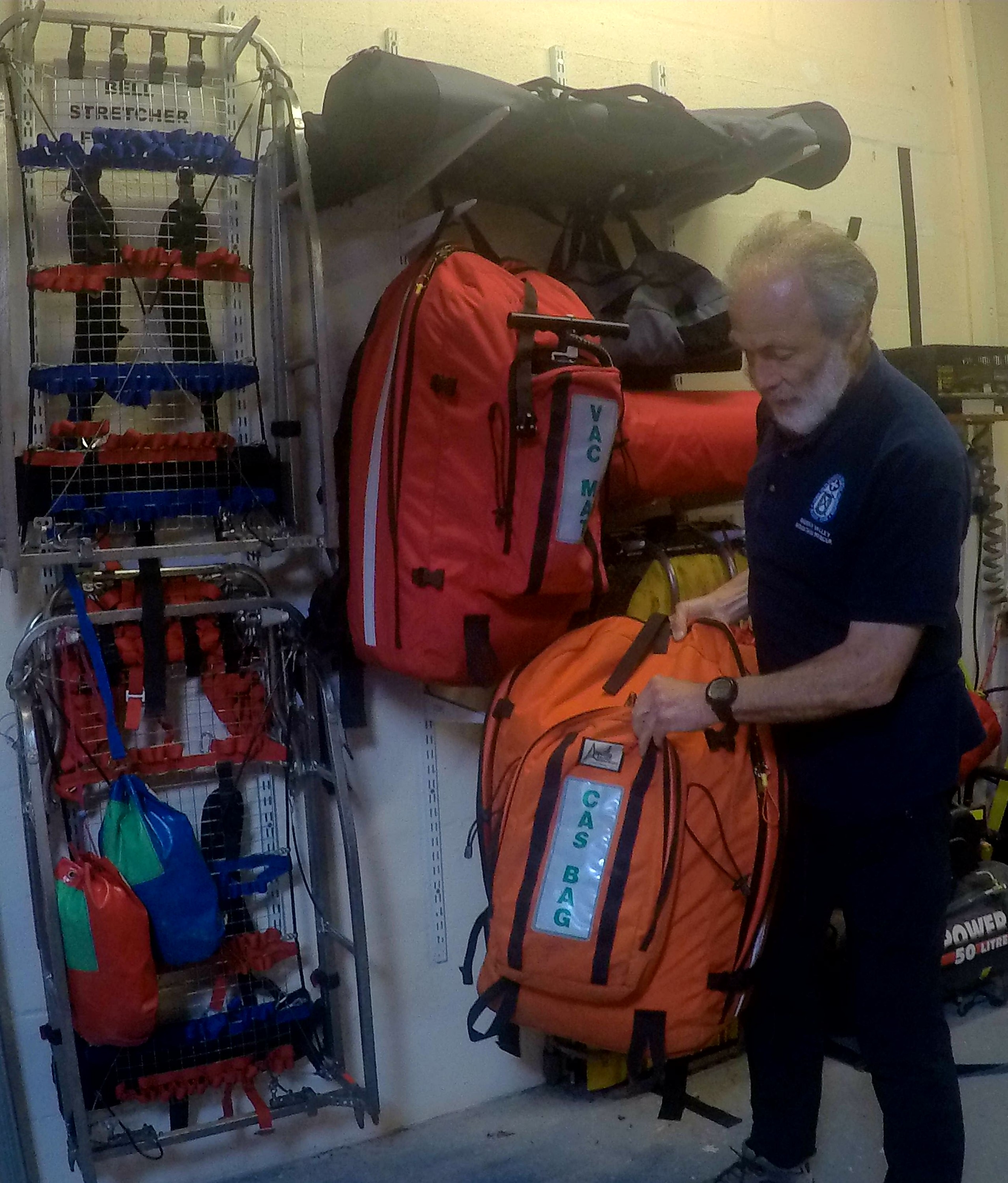
 Long serving Mountain Rescue team member Chris Lloyd demonstrating some of the teams vital equipment


 Stretchering a casualty off the hills is a huge undertaking. Photo courtesy of OVMRO.

After feeling a bit tetchy with the weight of the backpack I carry with me on my runs into the mountains I soon learned that I really have nothing to complain about when I hauled one of the backpacks that the rescue team members carry out on a callout. WOW! Heavy enough just standing in the base, imagine hefting it up a mountain and in double quick time when on a rescue! One bit of kit that I would like to add to my pack (just in cases!) was a vacuum splint. Contrary to how I thought these worked – by inflating around the patient to hold them still, which could actually be disastrous in the event of it cutting off circulation – these great bits of medical kit are positioned around the limb and then the air is sucked out of them, moulding perfectly to the limb and feeling almost solid – very impressive. As broken or sprained limbs are often a result of an accident in the hills these splints are incredibly useful, being lightweight to carry, quick and easy to apply and very effective.

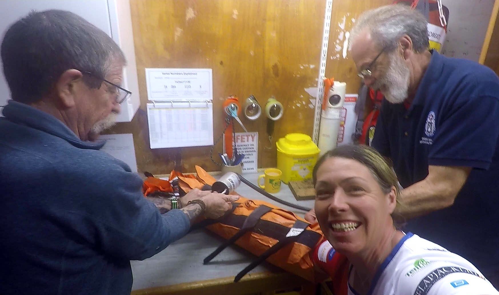
 Jed and Chris immobilizing me in the vacuum splint!

Before I knew it was time for everyone to head home for some well deserved rest but not before I was regaled with some fantastic stories from Chris, who, as a full member of the team since 1977, certainly had a lot of tales to tell including the time recently when The Duke and Duchess of Cambridge also stopped off for a cup of tea, landing by helicopter just behind the base. Apparently, according to Kate , HRH Prince William makes an excellent brew, but is a bit rubbish at the washing up!

 The Wall of names of the volunteer team members over the history of the organisation.

With no shortage of popular peaks within their jurisdiction you would think the team had more than enough mountain callouts to keep them busy, and they do, but the work does not stop there. The team is also involved in very many situations to assist the emergency services who may struggle to reach casualties. With their diverse range of training and skills Mountain Rescue Teams are often called upon for their help in floods, heavy winter weather, accidents in fast moving water, and any situation in remote or hard to reach locations. They now even train in evidence collection in order to accurately record details of an incident to pass over to the police, who are unable to reach the scene.

You can learn more about the fantastic work of Ogwen Valley Mountain Rescue Organisation on their website at OVMRO and Mountain Rescue England & Wales at https://www.mountain.rescue.org.uk . I am #RunningtheSummits – climbing 1000 Mountains of The British Isles in 365 days to raise awareness and funds to support the life saving work of these amazing volunteer teams. Please support them if you can at

https://virginmoneygiving.com/runningthesummits .

A Mountainous THANK YOU! 💕😊

Follow the challenge online at Running the Summits on Facebook!

Making a Right Hash of it!

A Quite Unusual New Running Experience

For many years I have noticed runners with ‘Hash House Harriers’ on their running vests prefixed with nationwide locations to their name. Bizarrely, despite having an occasional momentary wonder about the meaning of the name, I had never yet discovered it…….until……

The hashing ‘hounds’ hareing off “On On” the trail…

A spontaneous visit to Tamar Valley’s weekly ParkRun which was having a takeover week by the Tamar Valley Hash House Harriers resulted in, not only my premier ParkRun experience, but also an invite to join the ‘hashers’ for their next weekly ‘hash’ ….I had it on good authority that the ‘hares’ this week were particularly excellent – a bit worrying as I mostly follow a vegetarian diet!

Be sure to give the ‘Chalk Talk” your full attention!

To clarify my confusion a little the enthusiastic Harrier recruiters explained some background. The Hash House Harriers (which from here on I will refer to as HHH or H3 in an effort to avoid repetitive strain injury from all the additional typing) is an international group of non-competitive running social clubs, with a strong emphasis on the social. So social in fact it is jokingly said that they are a drinking club with a running problem! ( I say ‘jokingly’ 🤔?!) An event organized by a club is known as a hash, hash run or simply, hashing, with participants calling themselves hashers or hares and hounds. The important thing to understand is that these are merely titles and there are no actual animals or indeed ‘hash’ involved!

A Dark Disappearance into the Depths of Dartmoor

It was all originally formed in Malaysia in 1938 when groups of British Military Officers and ex-pats began meeting on Mondays to run in the style of a British ‘paper chase’ in an effort to run off the indulgent excesses of the weekend. After fading away during World War II it restarted during the late 1940’s and in the 1970’s did the equivalent of modern day ‘going viral’ and gaining huge popularity.

Back in the day setting up a group constitution it was stated :-

Apart from the excitement of chasing the hare and finding the trail, harriers reaching the end of the trail would partake of beer, ginger beer and cigarettes.

Perhaps NOT the best healthy lifestyle advice, though the objectives of the Hash House Harriers as recorded on the club registration card dated 1950 were :

  • To promote physical fitness among our members
  • To get rid of weekend hangovers
  • To acquire a good thirst and to satisfy it in beer
  • To persuade the older members that they are not as old as they feel

There are now over 2000 3H groups globally so a member can get their fix wherever life takes them.

The Tamar Valley Hash House Harriers ready for the off!

So… how do you hash?

The best thing is you don’t have to have a clue what goes on the first time you show up, just follow the madness and soon you will be picking up the meaning of the flour symbols scattered around what seems to be a ridiculously erratic course, understanding the loud cries of ” On On”, probably getting poked in the eye by an errant tree branch and before you know it, sitting in the pub looking dazed and confused and wondering what on earth just happened! A fundamental point of the hash is to be fun and to never be taken seriously. There are zero cares for PB’s or Split times on this run. But they are certainly getting something right as some of the Tamar Valley H3 members I spoke to had been hashing for over 30 years.

Always expect to get your feet wet….and possibly your hair!

A word of jovial warning – levels of ‘wildness’ can vary from group to group with some groups considering themselves “one of the tame ones”. If you are of a more sensitive disposition it might be prudent to find a tamer group for your first experience to avoid potentially being traumatised for life. The course is often no holds barred and forget about sticking to paths – crawling under low overhanging trees through woodland is deemed fair game and watercourses and rivers perhaps just cause for a mere, momentary pause, simply to confirm the route you understand – no one cares about looking for a bridge! I got lucky this first time, returning safely back with ( relatively) dry feet and all my limbs still attached, an outcome that is not entirely guaranteed.

Getting a bit side-tracked on the annual ‘red run’ – and this is BEFORE the pub!

A couple of people whom, it may be insinuated, have slightly sadistic tendencies will volunteer as the ‘hares’ – their job being to lay the trail for the group to decifer and follow. Symbols with various meaning are made on the ground with flour, sawdust or chalk. Then the whole group dart off chasing this trail of floury ‘breadcrumbs’ shouting fairly indeciferable instructions in code back to the rest of the group. . If i had remembered amid all the excitement to start my Strava recording I have no doubt the route would have looked something like this….

As clear as a ball of string!

However, within this madness true genius lies for the creation of the course enables everyone to participate, from super fast cross country sprinters all pepped up on sugar to ambling walkers stopping off for a nice cup of tea along the way. The course plays out so that the speedy spurters get sent off around a big old loop to meet back with the steady shufflers who were on a more direct trajectory. False trails are laid to further fox the eager beavers and give tentative trotters a chance to catch up thus ensuring the whole group stay relatively close together for the duration. Furthermore, though there is some very basic and extremely minimal guidance to hash etiquette normal race rules do not apply and shortcutting , far from being punished, is highly encouraged, though may receive some additional ribbing in the pub if it becomes a common and, more annoyingly, successfully tactical habit. To give you an idea, an example from the Tamar Valley H3 ‘rulebook’ reads as :-

Always try to keep at least one hasher between you and anything which looks at all fierce such as bulls, pit-bull terriers, landed gentry, geese and pigs.

In the interests of safety a ‘scribe’ is elected to act as mother hen, noting all hashers and checking them all safely back in at the end of the hash . H3’s NEVER leave a hasher behind! However, if you do intend to join the group at the pub afterwards you are then on your own so be sure to plan ahead.

Hash House Harriers : Never to be taken seriously!

There is also some unique hash code lingo to get to grips with. As a “Virgin” or “Just John” who doesn’t know their “shiggy” from their “dead trails” listen up to the “chalk talk” before the off, so you can correctly negotiate a “check”, avoid a “check back”, respond appropriately to an “RU” and most importantly keep “On On” to “On home” so you may go “on down” to the “circle” where there may be a “down down” afterwards. Easy for me to say,

Nothing better than a bit of a sing song and a beer after your daily run!

Remember, it is all a bit tongue in cheek and regulars are known by cheeky ‘hash names’ which can be a bit risque to say the least – likely harking back to hashings’ beginnings in a more politically incorrect time. Hashing newbies cannot name themselves but will earn an appropriate name by some head nodding achievement or wild stupidity demonstrated along the trail. Indeed, new hashers should beware of trying to influence their own hash name for risk of being re- christened with a more offensive or inappropriate name. In contrast, any rebels trying to gain a shocking monica will more likely be awarded a softie hash name such as “Twinkle”.

A tea ‘naming’ ceremony?

The highly prestigious Toilet Seat Award for some well sustained hash longevity

Personally, the elements that I enjoyed most about the hash ( aside from “on down” at the pub after ) was being able to run around after dark with no concerns about navigating or worrying where I was, just following the group ; the stop/start nature of the run and the fact that there was so much to focus on that there was none of the ‘this is hard work’ feeling which often accompanies a more convential run ; and that it was just pure, childlike, adventurous, fun!

Hashing chapters also don’t confine themselves to just two feet. Following roughly the same principles you can join a group Hashing by Bike or even Snorkel Hashing – I would be VERY wary of this latter malarkey!

It was lovely to see Charlotte , aka “Footloose” receive her tea pot celebrating 100 hash’s

I can absolutely and heartily recommend visiting one of these fun, mad, highly social events. Look up your local H3 chapter, leave any inhibitions at home and go along and have a fantastic “virgin hash”. If you have been a little alarmed by what you have read here don’t loose hope as there do exist many levels of H3 and very ‘family friendly’ groups are out there if you would rather avoid too much innuendo strewn banter. Checking out a charters website and having a read of one of their hash mags will give you a full ‘heads up’ of where they sit on the scale of Carry On style cheekiness.

See you at the ‘On Down’ 👍🍻

Huge thanks to the Tamar Valley Hash House Harriers for making me so welcome and introducing me to this zany pastime as well as their very kind donation to the Running the Summits fundraising for Mountain Rescue England and Wales, the Mountain Rescue Search Dogs and Fix the Fells.

⊙Photos (mostly) courtesy of Tamar Valley Hash House Harriers. Small disclaimer : apologies for any slightly risque double entendre phrasing in this blog – I can only put it down to the bad influence I have been under. (Ooo’err)

251 Mountains – the Zen post.

You wait for a post then two come along at the same time. So much has happened since I last wrote that I didn’t know where to start or what to write about to update this highly neglected blog site so I decided here to put down some ‘keeping it real’ thoughts after yesterday passing the 250 mountain mark and 25% completion of the Running the Summits challenge. If this post sounds a bit too touchy feely and you prefer your yang to your yin check out the alternative 251 Mountains – The Wahoo post 👊

Right now, the Brecon Beacons are just outside the window. I can’t see them, lost as they are to the clouds, curtains of rain drifting across my view of only the very lowest of the lower slopes. Even the sheep are huddled close into a tree sheltered corner. It’s the third consecutive day of unfathomably and distinctly eclectic weather – one of deep snow and teeth chattering wind chill, one of warmth and clear sunny skies and today, one of wet, claggy cloud and sheets of rain. I was well overdue in taking some time out to get caught up on those real life chores – refilling water supplies, doing laundry, scraping all the farmland muck off the campervan and responding to weeks of emails. Yet, still, early this morning I peeled on my slightly damp, offensively smelly running gear, eager to be out, hauling my (as yet still not athletically-toned) bum up a mountain or two. I think it has become a mantra.

It is said about the Camino de Santiago – a favourite long distance escape of mine – that there are three stages to the endeavour. Firstly the physical, as our body aches and suffers at the sudden increased demands put upon it until it miraculously adapts and grows stronger.

Free from the physical distractions the second stage is the emotional as our minds gradually move from doubt, fear and questioning to perspective and acceptance. Finally, the third stage is that of the spiritual where, only because we have passed through the first two stages and shed the unnecessary can we now fully experience a total awareness, immersion and gained sense of freedom. While specifically aimed at the experience of the Camino I strongly believe that any adventure, large or small can be a great metaphor for life with many lessons to be learned.

Zen and the Art of Adventurous Living?

Now, I still think my body has some considerable ongoing work at Stage one (as mentioned, I had been expecting to, at least slightly, resemble the streamlined physique of an athlete by this point) and trying to run uphill just doesn’t seem to be getting any easier. To be fair both of these issues could be explained by cake.


Possibly the reason I do NOT look like a finely honed machine!?

But even with a lingering toe or two in stage one I do feel I have made some small progress to the great blue orb of enlightenment. I have indeed discovered that this, as all adventures in life, can best be described using that oft spouted clichéd saying ‘It’s been a journey’ (and is going to continue to be a journey for some considerable time as I still have 749 summits to run). But as well as dipping my toes, usually unintentionally, into bog, rivers, bog and more bog I also feel I have been dipping them into stages 2 and 3 and learning a thing or two. (just not how to avoid bog!). As in life, we do not move cleanly from one stage to the next but there is a blurring of the edges and knock backs when new challenges fall out of a cupboard and smack us in the head (also metaphorical – if I have grasped the correct use of the concept!?)


Patch – The Enlightened One

Super-enthused adventurer Anna McNuff wrote a wonderful poem (1) along a similar vein telling of a journey that begins doing battle with nature – setting out to conquer, before becoming beaten down by nature’s far superior and ambivalent….well, nature! Eventually, this traveller no longer passes through or against but travels with and in this natural environment. This is the journey I have been really hoping and expecting to make and I am already becoming familiar with the elements (literal and metaphorical).

On the 251st Mountain summit, I sat for a long while (as long as was possible before extremities started to go numb) fully absorbing the views, the solitude, the peace, the simplicity and vastness of the landscape around me, calm and happy to be right where I was, unencumbered by concerns or stresses. As the terrain and climatic challenges grow greater it is liberating to gradually become confident and at ease in your surroundings as you learn and use new found skills and understanding. There is still an awful lot to learn but hopefully I am becoming willing and humble enough to listen and appreciate all that the mountains have yet to teach.

On a literal note I am throwing in a reminder that my Mountain Joggist Extravaganza is also in hopes of raising a few well needed squidlies for the amazing volunteers of Mountain Rescue England & Wales, Mountain Rescue Search Dogs(the doggy rescuers formally known as Search and Rescue Dog Association England!) and Fix the Fells.

Please spare a pound to chuck in the bucket if you can HERE😁 Thank You

It’s also really easy to donate by text too…. just text TOPS50 followed by an amount to 70070 . Thank You❤

(1) PS. Anna McNuff’s poem is featured in the book Waymaking – an anthology of prose, poetry and artwork by women who are inspired by wild places, adventure and landscape.

Happy trails 😊👣🐾

Screenshot_20190205-194111